You are here: Home > Network List > CI - Caltech Regional Seismic Network Stations List
> Station NEE2 Needles Airport > Earthquake Result Viewer
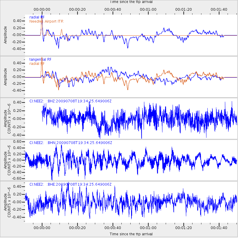
NEE2 Needles Airport - Earthquake Result Viewer
*The percent match for this event was below the threshold and hence no stack was calculated.
| Earthquake location: |
Southeast Of Easter Island |
| Earthquake latitude/longitude: |
-36.0/-102.7 |
| Earthquake time(UTC): |
2009/07/08 (189) 19:23:37 GMT |
| Earthquake Depth: |
12 km |
| Earthquake Magnitude: |
5.5 MS, 5.4 MB, 6.0 MW, 5.9 MW |
| Earthquake Catalog/Contributor: |
WHDF/NEIC |
|
| Network: |
CI Caltech Regional Seismic Network |
| Station: |
NEE2 Needles Airport |
| Lat/Lon: |
34.77 N/114.62 W |
| Elevation: |
271 m |
|
| Distance: |
71.3 deg |
| Az: |
349.646 deg |
| Baz: |
169.804 deg |
| Ray Param: |
$rayparam |
*The percent match for this event was below the threshold and hence was not used in the summary stack. |
|
| Radial Match: |
56.267937 % |
| Radial Bump: |
400 |
| Transverse Match: |
43.826843 % |
| Transverse Bump: |
400 |
| SOD ConfigId: |
2648 |
| Insert Time: |
2010-02-26 00:23:50.344 +0000 |
| GWidth: |
2.5 |
| Max Bumps: |
400 |
| Tol: |
0.001 |
|
Signal To Noise
| Channel | StoN | STA | LTA |
| CI:NEE2: :BHN:20090708T19:34:25.649006Z | 0.92831236 | 1.1073618E-7 | 1.1928763E-7 |
| CI:NEE2: :BHE:20090708T19:34:25.649006Z | 0.662508 | 1.11855485E-7 | 1.6883642E-7 |
| CI:NEE2: :BHZ:20090708T19:34:25.649006Z | 1.8968705 | 2.2829106E-7 | 1.2035142E-7 |
| Arrivals |
| Ps | |
| PpPs | |
| PsPs/PpSs | |


