BW06 Boulder Array Site 6 (Pinedale), Wyoming, USA - Earthquake Result Viewer
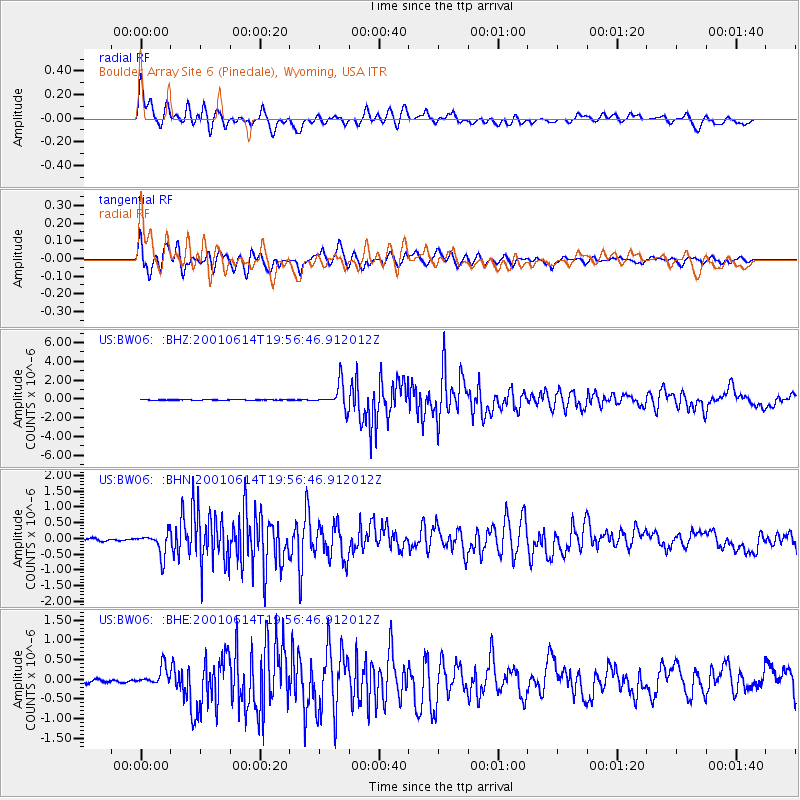
Earthquake location: Andreanof Islands, Aleutian Is.
Earthquake latitude/longitude: 51.2/-179.8
Earthquake time(UTC): 2001/06/14 (165) 19:48:47 GMT
Earthquake Depth: 18 km
Earthquake Magnitude: 6.0 MB, 6.3 MS, 6.5 MW, 6.1 ML
Earthquake Catalog/Contributor: WHDF/NEIC
Network: US United States National Seismic Network
Station: BW06 Boulder Array Site 6 (Pinedale), Wyoming, USA
Lat/Lon: 42.77 N/109.56 W
Elevation: 2224 m
Distance: 47.0 deg
Az: 71.427 deg
Baz: 305.847 deg
Ray Param: 0.07026625
Estimated Moho Depth: 43.0 km
Estimated Crust Vp/Vs: 2.10
Assumed Crust Vp: 6.161 km/s
Estimated Crust Vs: 2.937 km/s
Estimated Crust Poisson's Ratio: 0.35
Radial Match: 93.90765 %
Radial Bump: 400
Transverse Match: 92.16798 %
Transverse Bump: 400
SOD ConfigId: 110165
Insert Time: 2010-03-05 03:34:24.488 +0000
GWidth: 2.5
Max Bumps: 400
Tol: 0.001

Signal To Noise

ChannelStoNSTALTA
US:BW06: :BHN:20010614T19:56:46.912012Z9.4327093.5620536E-73.7762785E-8
US:BW06: :BHE:20010614T19:56:46.912012Z5.9293182.2998793E-73.878826E-8
US:BW06: :BHZ:20010614T19:56:46.912012Z40.292781.2950754E-63.2141624E-8
Arrivals
Ps8.0 SECOND
PpPs21 SECOND
PsPs/PpSs29 SECOND