You are here: Home > Network List > G - GEOSCOPE Stations List
> Station MPG Montagne des Peres, French Guyana > Earthquake Result Viewer
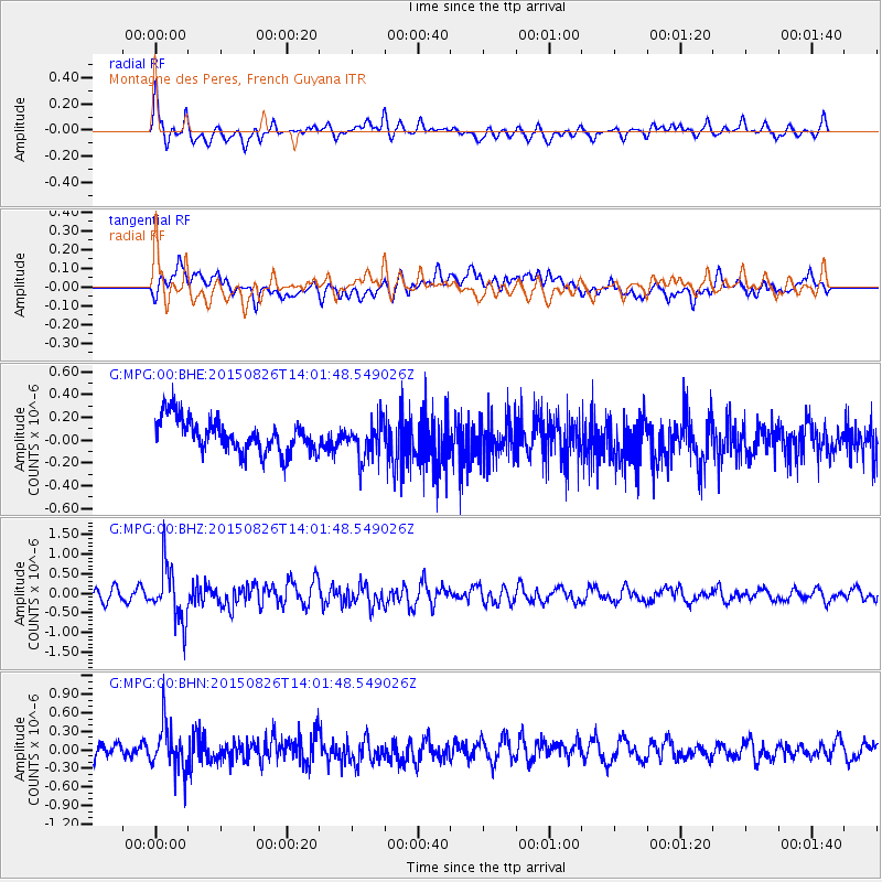
MPG Montagne des Peres, French Guyana - Earthquake Result Viewer
*The percent match for this event was below the threshold and hence no stack was calculated.
| Earthquake location: |
South Sandwich Islands Region |
| Earthquake latitude/longitude: |
-57.5/-26.0 |
| Earthquake time(UTC): |
2015/08/26 (238) 13:51:39 GMT |
| Earthquake Depth: |
64 km |
| Earthquake Magnitude: |
5.7 MB |
| Earthquake Catalog/Contributor: |
NEIC PDE/NEIC COMCAT |
|
| Network: |
G GEOSCOPE |
| Station: |
MPG Montagne des Peres, French Guyana |
| Lat/Lon: |
5.11 N/52.64 W |
| Elevation: |
147 m |
|
| Distance: |
66.0 deg |
| Az: |
330.688 deg |
| Baz: |
164.607 deg |
| Ray Param: |
$rayparam |
*The percent match for this event was below the threshold and hence was not used in the summary stack. |
|
| Radial Match: |
67.01932 % |
| Radial Bump: |
400 |
| Transverse Match: |
45.986362 % |
| Transverse Bump: |
400 |
| SOD ConfigId: |
1085051 |
| Insert Time: |
2015-09-09 14:05:39.225 +0000 |
| GWidth: |
2.5 |
| Max Bumps: |
400 |
| Tol: |
0.001 |
|
Signal To Noise
| Channel | StoN | STA | LTA |
| G:MPG:00:BHZ:20150826T14:01:48.549026Z | 4.672864 | 6.9669136E-7 | 1.4909301E-7 |
| G:MPG:00:BHN:20150826T14:01:48.549026Z | 2.9111576 | 3.5233276E-7 | 1.210284E-7 |
| G:MPG:00:BHE:20150826T14:01:48.549026Z | 1.109376 | 1.6216593E-7 | 1.4617761E-7 |
| Arrivals |
| Ps | |
| PpPs | |
| PsPs/PpSs | |


