You are here: Home > Network List > CI - Caltech Regional Seismic Network Stations List
> Station DGR Domenigoni Reservoir, California, USA > Earthquake Result Viewer
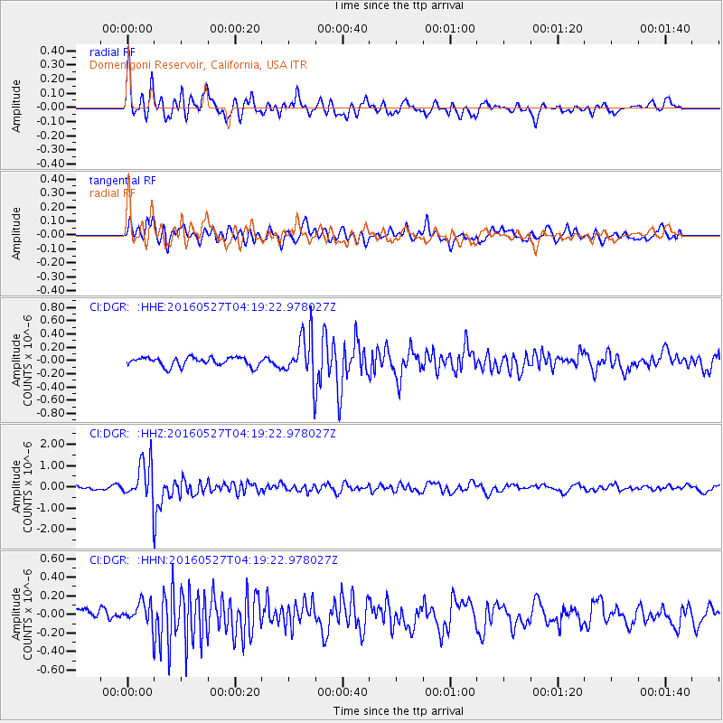
DGR Domenigoni Reservoir, California, USA - Earthquake Result Viewer
*The percent match for this event was below the threshold and hence no stack was calculated.
| Earthquake location: |
Fiji Islands Region |
| Earthquake latitude/longitude: |
-20.8/-178.7 |
| Earthquake time(UTC): |
2016/05/27 (148) 04:08:44 GMT |
| Earthquake Depth: |
572 km |
| Earthquake Magnitude: |
6.4 MO |
| Earthquake Catalog/Contributor: |
NEIC PDE/NEIC ALERT |
|
| Network: |
CI Caltech Regional Seismic Network |
| Station: |
DGR Domenigoni Reservoir, California, USA |
| Lat/Lon: |
33.65 N/117.01 W |
| Elevation: |
609 m |
|
| Distance: |
79.9 deg |
| Az: |
48.224 deg |
| Baz: |
236.753 deg |
| Ray Param: |
$rayparam |
*The percent match for this event was below the threshold and hence was not used in the summary stack. |
|
| Radial Match: |
77.51651 % |
| Radial Bump: |
400 |
| Transverse Match: |
72.008316 % |
| Transverse Bump: |
400 |
| SOD ConfigId: |
7422571 |
| Insert Time: |
2019-04-22 16:10:39.461 +0000 |
| GWidth: |
2.5 |
| Max Bumps: |
400 |
| Tol: |
0.001 |
|
Signal To Noise
| Channel | StoN | STA | LTA |
| CI:DGR: :HHZ:20160527T04:19:22.978027Z | 9.659308 | 9.640243E-7 | 9.980262E-8 |
| CI:DGR: :HHN:20160527T04:19:22.978027Z | 1.9887811 | 1.3144805E-7 | 6.609478E-8 |
| CI:DGR: :HHE:20160527T04:19:22.978027Z | 4.521802 | 3.0515815E-7 | 6.748596E-8 |
| Arrivals |
| Ps | |
| PpPs | |
| PsPs/PpSs | |


