You are here: Home > Network List > US - United States National Seismic Network Stations List
> Station BW06 Boulder Array Site 6 (Pinedale), Wyoming, USA > Earthquake Result Viewer
BW06 Boulder Array Site 6 (Pinedale), Wyoming, USA - Earthquake Result Viewer
| Earthquake location: |
Hokkaido, Japan Region |
| Earthquake latitude/longitude: |
41.8/143.9 |
| Earthquake time(UTC): |
2003/09/25 (268) 19:50:06 GMT |
| Earthquake Depth: |
27 km |
| Earthquake Magnitude: |
6.9 MB, 8.1 MS, 8.3 MW, 8.1 MW |
| Earthquake Catalog/Contributor: |
WHDF/NEIC |
|
| Network: |
US United States National Seismic Network |
| Station: |
BW06 Boulder Array Site 6 (Pinedale), Wyoming, USA |
| Lat/Lon: |
42.77 N/109.56 W |
| Elevation: |
2224 m |
|
| Distance: |
73.0 deg |
| Az: |
47.587 deg |
| Baz: |
311.457 deg |
| Ray Param: |
0.05327228 |
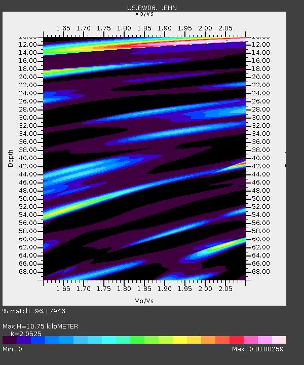
| Estimated Moho Depth: |
10.75 km |
| Estimated Crust Vp/Vs: |
2.05 |
| Assumed Crust Vp: |
6.161 km/s |
| Estimated Crust Vs: |
3.002 km/s |
| Estimated Crust Poisson's Ratio: |
0.34 |
|
| Radial Match: |
96.17946 % |
| Radial Bump: |
400 |
| Transverse Match: |
94.07992 % |
| Transverse Bump: |
400 |
| SOD ConfigId: |
110177 |
| Insert Time: |
2010-03-05 03:35:56.908 +0000 |
| GWidth: |
2.5 |
| Max Bumps: |
400 |
| Tol: |
0.001 |
|
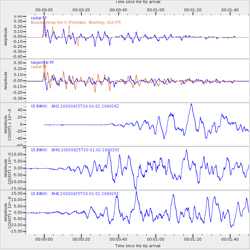
Signal To Noise
| Channel | StoN | STA | LTA |
| US:BW06: :BHN:20030925T20:01:02.299026Z | 1.8636135 | 2.3618544E-7 | 1.267352E-7 |
| US:BW06: :BHE:20030925T20:01:02.299026Z | 1.3876519 | 1.9457961E-7 | 1.402222E-7 |
| US:BW06: :BHZ:20030925T20:01:02.299026Z | 5.6557293 | 7.192266E-7 | 1.271678E-7 |
| Arrivals |
| Ps | 1.9 SECOND |
| PpPs | 5.2 SECOND |
| PsPs/PpSs | 7.1 SECOND |


