You are here: Home > Network List > TA - USArray Transportable Network (new EarthScope stations) Stations List
> Station 121A Cookes Peak, Deming, NM, USA > Earthquake Result Viewer
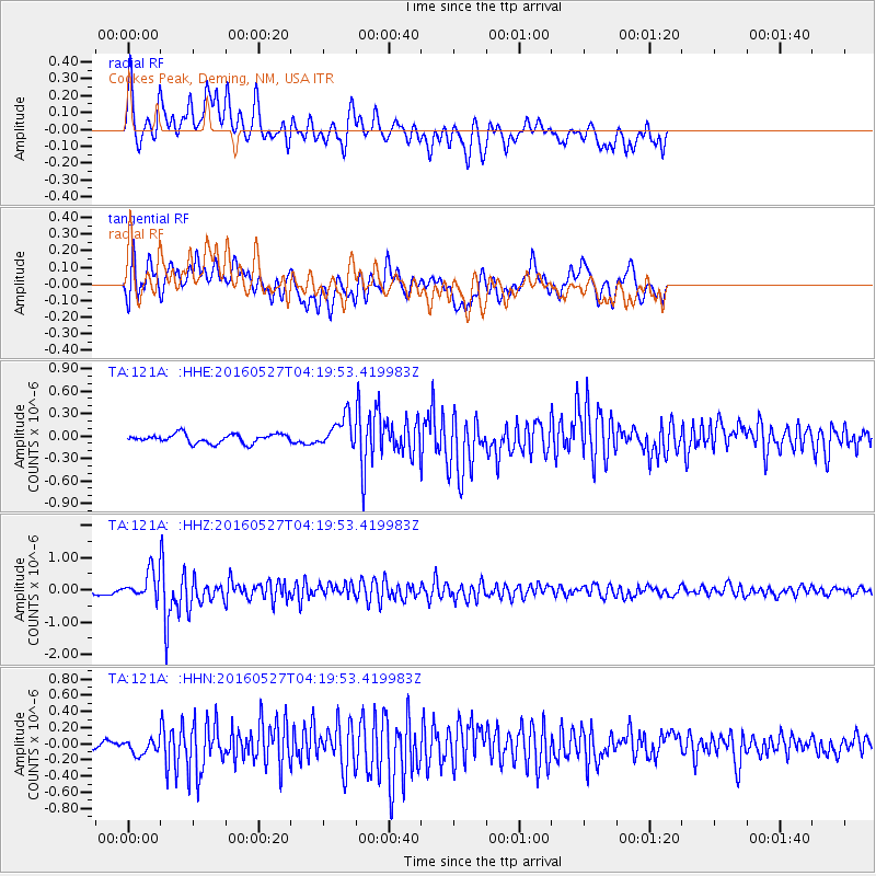
121A Cookes Peak, Deming, NM, USA - Earthquake Result Viewer
*The percent match for this event was below the threshold and hence no stack was calculated.
| Earthquake location: |
Fiji Islands Region |
| Earthquake latitude/longitude: |
-20.8/-178.7 |
| Earthquake time(UTC): |
2016/05/27 (148) 04:08:44 GMT |
| Earthquake Depth: |
572 km |
| Earthquake Magnitude: |
6.4 MO |
| Earthquake Catalog/Contributor: |
NEIC PDE/NEIC ALERT |
|
| Network: |
TA USArray Transportable Network (new EarthScope stations) |
| Station: |
121A Cookes Peak, Deming, NM, USA |
| Lat/Lon: |
32.53 N/107.79 W |
| Elevation: |
1652 m |
|
| Distance: |
86.0 deg |
| Az: |
53.138 deg |
| Baz: |
242.378 deg |
| Ray Param: |
$rayparam |
*The percent match for this event was below the threshold and hence was not used in the summary stack. |
|
| Radial Match: |
66.99871 % |
| Radial Bump: |
400 |
| Transverse Match: |
64.27344 % |
| Transverse Bump: |
400 |
| SOD ConfigId: |
7422571 |
| Insert Time: |
2019-04-22 16:14:37.776 +0000 |
| GWidth: |
2.5 |
| Max Bumps: |
400 |
| Tol: |
0.001 |
|
Signal To Noise
| Channel | StoN | STA | LTA |
| TA:121A: :HHZ:20160527T04:19:53.419983Z | 5.0666947 | 4.154555E-7 | 8.199734E-8 |
| TA:121A: :HHN:20160527T04:19:53.419983Z | 1.5606184 | 8.983567E-8 | 5.756415E-8 |
| TA:121A: :HHE:20160527T04:19:53.419983Z | 3.4180517 | 2.0542342E-7 | 6.0099566E-8 |
| Arrivals |
| Ps | |
| PpPs | |
| PsPs/PpSs | |


