You are here: Home > Network List > TA - USArray Transportable Network (new EarthScope stations) Stations List
> Station G03D McMinnville, OR, USA > Earthquake Result Viewer
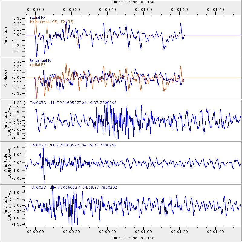
G03D McMinnville, OR, USA - Earthquake Result Viewer
*The percent match for this event was below the threshold and hence no stack was calculated.
| Earthquake location: |
Fiji Islands Region |
| Earthquake latitude/longitude: |
-20.8/-178.7 |
| Earthquake time(UTC): |
2016/05/27 (148) 04:08:44 GMT |
| Earthquake Depth: |
572 km |
| Earthquake Magnitude: |
6.4 MO |
| Earthquake Catalog/Contributor: |
NEIC PDE/NEIC ALERT |
|
| Network: |
TA USArray Transportable Network (new EarthScope stations) |
| Station: |
G03D McMinnville, OR, USA |
| Lat/Lon: |
45.21 N/123.26 W |
| Elevation: |
222 m |
|
| Distance: |
82.8 deg |
| Az: |
35.911 deg |
| Baz: |
230.914 deg |
| Ray Param: |
$rayparam |
*The percent match for this event was below the threshold and hence was not used in the summary stack. |
|
| Radial Match: |
50.452244 % |
| Radial Bump: |
400 |
| Transverse Match: |
52.017414 % |
| Transverse Bump: |
400 |
| SOD ConfigId: |
7422571 |
| Insert Time: |
2019-04-22 16:14:43.418 +0000 |
| GWidth: |
2.5 |
| Max Bumps: |
400 |
| Tol: |
0.001 |
|
Signal To Noise
| Channel | StoN | STA | LTA |
| TA:G03D: :HHZ:20160527T04:19:37.780029Z | 2.315896 | 8.2051685E-7 | 3.5429775E-7 |
| TA:G03D: :HHN:20160527T04:19:37.780029Z | 0.9482191 | 2.7177728E-7 | 2.8661867E-7 |
| TA:G03D: :HHE:20160527T04:19:37.780029Z | 1.0023948 | 3.1019414E-7 | 3.0945307E-7 |
| Arrivals |
| Ps | |
| PpPs | |
| PsPs/PpSs | |


