You are here: Home > Network List > TA - USArray Transportable Network (new EarthScope stations) Stations List
> Station J01E Myrtle Point, OR, USA > Earthquake Result Viewer
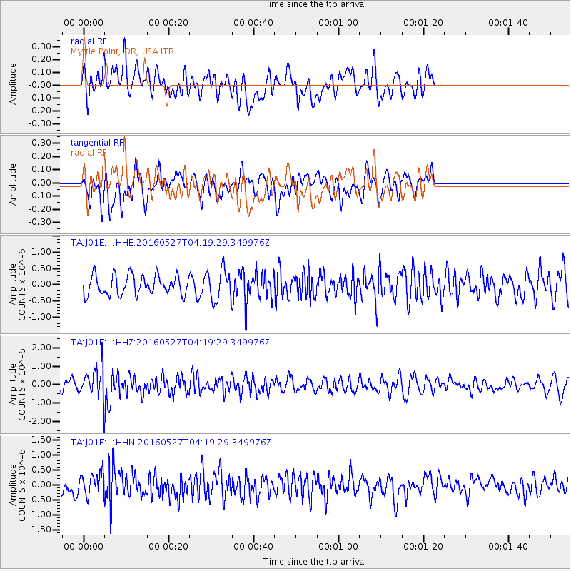
J01E Myrtle Point, OR, USA - Earthquake Result Viewer
*The percent match for this event was below the threshold and hence no stack was calculated.
| Earthquake location: |
Fiji Islands Region |
| Earthquake latitude/longitude: |
-20.8/-178.7 |
| Earthquake time(UTC): |
2016/05/27 (148) 04:08:44 GMT |
| Earthquake Depth: |
572 km |
| Earthquake Magnitude: |
6.4 MO |
| Earthquake Catalog/Contributor: |
NEIC PDE/NEIC ALERT |
|
| Network: |
TA USArray Transportable Network (new EarthScope stations) |
| Station: |
J01E Myrtle Point, OR, USA |
| Lat/Lon: |
43.16 N/123.93 W |
| Elevation: |
128 m |
|
| Distance: |
81.1 deg |
| Az: |
37.208 deg |
| Baz: |
230.631 deg |
| Ray Param: |
$rayparam |
*The percent match for this event was below the threshold and hence was not used in the summary stack. |
|
| Radial Match: |
51.993176 % |
| Radial Bump: |
400 |
| Transverse Match: |
64.824486 % |
| Transverse Bump: |
400 |
| SOD ConfigId: |
7422571 |
| Insert Time: |
2019-04-22 16:14:55.507 +0000 |
| GWidth: |
2.5 |
| Max Bumps: |
400 |
| Tol: |
0.001 |
|
Signal To Noise
| Channel | StoN | STA | LTA |
| TA:J01E: :HHZ:20160527T04:19:29.349976Z | 2.890498 | 8.139714E-7 | 2.8160247E-7 |
| TA:J01E: :HHN:20160527T04:19:29.349976Z | 1.1713483 | 3.9281144E-7 | 3.3534982E-7 |
| TA:J01E: :HHE:20160527T04:19:29.349976Z | 1.6081405 | 4.7566976E-7 | 2.9578868E-7 |
| Arrivals |
| Ps | |
| PpPs | |
| PsPs/PpSs | |


