You are here: Home > Network List > TA - USArray Transportable Network (new EarthScope stations) Stations List
> Station MSTX Muleshoe, TX, USA > Earthquake Result Viewer
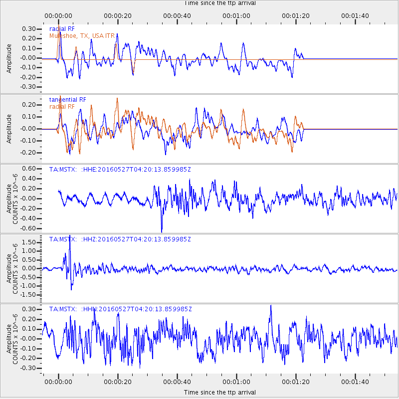
MSTX Muleshoe, TX, USA - Earthquake Result Viewer
*The percent match for this event was below the threshold and hence no stack was calculated.
| Earthquake location: |
Fiji Islands Region |
| Earthquake latitude/longitude: |
-20.8/-178.7 |
| Earthquake time(UTC): |
2016/05/27 (148) 04:08:44 GMT |
| Earthquake Depth: |
572 km |
| Earthquake Magnitude: |
6.4 MO |
| Earthquake Catalog/Contributor: |
NEIC PDE/NEIC ALERT |
|
| Network: |
TA USArray Transportable Network (new EarthScope stations) |
| Station: |
MSTX Muleshoe, TX, USA |
| Lat/Lon: |
33.97 N/102.77 W |
| Elevation: |
1167 m |
|
| Distance: |
90.4 deg |
| Az: |
53.711 deg |
| Baz: |
245.133 deg |
| Ray Param: |
$rayparam |
*The percent match for this event was below the threshold and hence was not used in the summary stack. |
|
| Radial Match: |
65.6312 % |
| Radial Bump: |
400 |
| Transverse Match: |
58.368603 % |
| Transverse Bump: |
400 |
| SOD ConfigId: |
7422571 |
| Insert Time: |
2019-04-22 16:15:18.525 +0000 |
| GWidth: |
2.5 |
| Max Bumps: |
400 |
| Tol: |
0.001 |
|
Signal To Noise
| Channel | StoN | STA | LTA |
| TA:MSTX: :HHZ:20160527T04:20:13.859985Z | 6.588447 | 5.9084766E-7 | 8.967935E-8 |
| TA:MSTX: :HHN:20160527T04:20:13.859985Z | 1.4920298 | 1.2249735E-7 | 8.2101145E-8 |
| TA:MSTX: :HHE:20160527T04:20:13.859985Z | 1.6432602 | 1.25845E-7 | 7.6582516E-8 |
| Arrivals |
| Ps | |
| PpPs | |
| PsPs/PpSs | |


