You are here: Home > Network List > UW - Pacific Northwest Regional Seismic Network Stations List
> Station LEBA Lebam, WA, USA > Earthquake Result Viewer
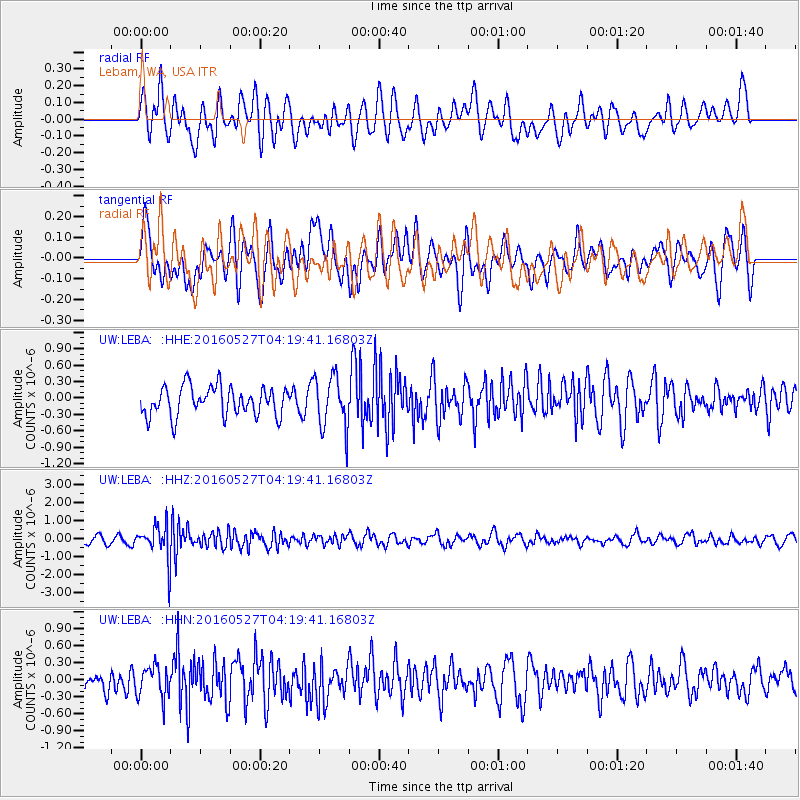
LEBA Lebam, WA, USA - Earthquake Result Viewer
*The percent match for this event was below the threshold and hence no stack was calculated.
| Earthquake location: |
Fiji Islands Region |
| Earthquake latitude/longitude: |
-20.8/-178.7 |
| Earthquake time(UTC): |
2016/05/27 (148) 04:08:44 GMT |
| Earthquake Depth: |
572 km |
| Earthquake Magnitude: |
6.4 MO |
| Earthquake Catalog/Contributor: |
NEIC PDE/NEIC ALERT |
|
| Network: |
UW Pacific Northwest Regional Seismic Network |
| Station: |
LEBA Lebam, WA, USA |
| Lat/Lon: |
46.55 N/123.56 W |
| Elevation: |
73 m |
|
| Distance: |
83.5 deg |
| Az: |
34.737 deg |
| Baz: |
230.559 deg |
| Ray Param: |
$rayparam |
*The percent match for this event was below the threshold and hence was not used in the summary stack. |
|
| Radial Match: |
58.91739 % |
| Radial Bump: |
400 |
| Transverse Match: |
62.419403 % |
| Transverse Bump: |
400 |
| SOD ConfigId: |
7422571 |
| Insert Time: |
2019-04-22 16:16:21.454 +0000 |
| GWidth: |
2.5 |
| Max Bumps: |
400 |
| Tol: |
0.001 |
|
Signal To Noise
| Channel | StoN | STA | LTA |
| UW:LEBA: :HHZ:20160527T04:19:41.16803Z | 3.4321117 | 9.885632E-7 | 2.880335E-7 |
| UW:LEBA: :HHN:20160527T04:19:41.16803Z | 1.4633611 | 2.7631418E-7 | 1.8882157E-7 |
| UW:LEBA: :HHE:20160527T04:19:41.16803Z | 1.7875949 | 4.762731E-7 | 2.6643235E-7 |
| Arrivals |
| Ps | |
| PpPs | |
| PsPs/PpSs | |


