You are here: Home > Network List > UW - Pacific Northwest Regional Seismic Network Stations List
> Station UMAT Pilot Rock, OR, USA > Earthquake Result Viewer
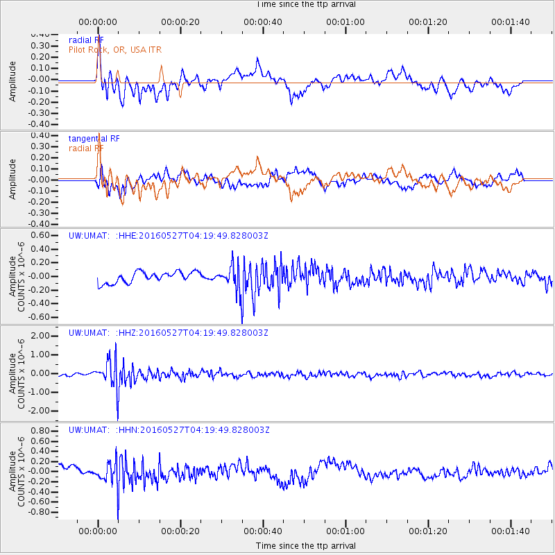
UMAT Pilot Rock, OR, USA - Earthquake Result Viewer
*The percent match for this event was below the threshold and hence no stack was calculated.
| Earthquake location: |
Fiji Islands Region |
| Earthquake latitude/longitude: |
-20.8/-178.7 |
| Earthquake time(UTC): |
2016/05/27 (148) 04:08:44 GMT |
| Earthquake Depth: |
572 km |
| Earthquake Magnitude: |
6.4 MO |
| Earthquake Catalog/Contributor: |
NEIC PDE/NEIC ALERT |
|
| Network: |
UW Pacific Northwest Regional Seismic Network |
| Station: |
UMAT Pilot Rock, OR, USA |
| Lat/Lon: |
45.29 N/118.96 W |
| Elevation: |
1318 m |
|
| Distance: |
85.3 deg |
| Az: |
37.708 deg |
| Baz: |
234.148 deg |
| Ray Param: |
$rayparam |
*The percent match for this event was below the threshold and hence was not used in the summary stack. |
|
| Radial Match: |
64.20258 % |
| Radial Bump: |
400 |
| Transverse Match: |
60.672775 % |
| Transverse Bump: |
400 |
| SOD ConfigId: |
7422571 |
| Insert Time: |
2019-04-22 16:16:31.603 +0000 |
| GWidth: |
2.5 |
| Max Bumps: |
400 |
| Tol: |
0.001 |
|
Signal To Noise
| Channel | StoN | STA | LTA |
| UW:UMAT: :HHZ:20160527T04:19:49.828003Z | 10.502923 | 7.8029683E-7 | 7.42933E-8 |
| UW:UMAT: :HHN:20160527T04:19:49.828003Z | 2.0266256 | 2.3697513E-7 | 1.16930885E-7 |
| UW:UMAT: :HHE:20160527T04:19:49.828003Z | 2.0133672 | 1.6241964E-7 | 8.067065E-8 |
| Arrivals |
| Ps | |
| PpPs | |
| PsPs/PpSs | |


