You are here: Home > Network List > TA - USArray Transportable Network (new EarthScope stations) Stations List
> Station G05D Wamic, OR, USA > Earthquake Result Viewer
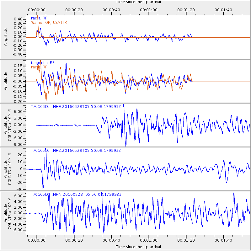
G05D Wamic, OR, USA - Earthquake Result Viewer
*The percent match for this event was below the threshold and hence no stack was calculated.
| Earthquake location: |
South Of Fiji Islands |
| Earthquake latitude/longitude: |
-22.0/-178.2 |
| Earthquake time(UTC): |
2016/05/28 (149) 05:38:51 GMT |
| Earthquake Depth: |
417 km |
| Earthquake Magnitude: |
6.6 MO |
| Earthquake Catalog/Contributor: |
NEIC PDE/NEIC ALERT |
|
| Network: |
TA USArray Transportable Network (new EarthScope stations) |
| Station: |
G05D Wamic, OR, USA |
| Lat/Lon: |
45.24 N/121.32 W |
| Elevation: |
592 m |
|
| Distance: |
84.6 deg |
| Az: |
36.451 deg |
| Baz: |
231.292 deg |
| Ray Param: |
$rayparam |
*The percent match for this event was below the threshold and hence was not used in the summary stack. |
|
| Radial Match: |
66.4452 % |
| Radial Bump: |
400 |
| Transverse Match: |
68.70841 % |
| Transverse Bump: |
400 |
| SOD ConfigId: |
7422571 |
| Insert Time: |
2019-04-22 16:28:02.813 +0000 |
| GWidth: |
2.5 |
| Max Bumps: |
400 |
| Tol: |
0.001 |
|
Signal To Noise
| Channel | StoN | STA | LTA |
| TA:G05D: :HHZ:20160528T05:50:08.179993Z | 79.75887 | 1.2890408E-5 | 1.6161724E-7 |
| TA:G05D: :HHN:20160528T05:50:08.179993Z | 5.6552167 | 1.0862435E-6 | 1.9207815E-7 |
| TA:G05D: :HHE:20160528T05:50:08.179993Z | 10.226683 | 1.5043838E-6 | 1.4710379E-7 |
| Arrivals |
| Ps | |
| PpPs | |
| PsPs/PpSs | |


