You are here: Home > Network List > TA - USArray Transportable Network (new EarthScope stations) Stations List
> Station M31M Drury Creek, Yukon, CA > Earthquake Result Viewer
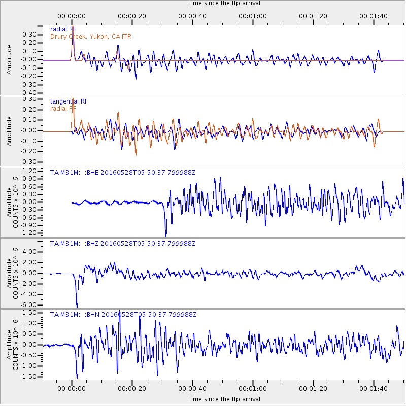
M31M Drury Creek, Yukon, CA - Earthquake Result Viewer
*The percent match for this event was below the threshold and hence no stack was calculated.
| Earthquake location: |
South Of Fiji Islands |
| Earthquake latitude/longitude: |
-22.0/-178.2 |
| Earthquake time(UTC): |
2016/05/28 (149) 05:38:51 GMT |
| Earthquake Depth: |
417 km |
| Earthquake Magnitude: |
6.6 MO |
| Earthquake Catalog/Contributor: |
NEIC PDE/NEIC ALERT |
|
| Network: |
TA USArray Transportable Network (new EarthScope stations) |
| Station: |
M31M Drury Creek, Yukon, CA |
| Lat/Lon: |
62.20 N/134.39 W |
| Elevation: |
639 m |
|
| Distance: |
90.9 deg |
| Az: |
18.926 deg |
| Baz: |
219.939 deg |
| Ray Param: |
$rayparam |
*The percent match for this event was below the threshold and hence was not used in the summary stack. |
|
| Radial Match: |
76.999825 % |
| Radial Bump: |
400 |
| Transverse Match: |
77.350426 % |
| Transverse Bump: |
400 |
| SOD ConfigId: |
7422571 |
| Insert Time: |
2019-04-22 16:28:41.393 +0000 |
| GWidth: |
2.5 |
| Max Bumps: |
400 |
| Tol: |
0.001 |
|
Signal To Noise
| Channel | StoN | STA | LTA |
| TA:M31M: :BHZ:20160528T05:50:37.799988Z | 46.83768 | 2.0907555E-6 | 4.4638323E-8 |
| TA:M31M: :BHN:20160528T05:50:37.799988Z | 17.813936 | 5.575822E-7 | 3.130034E-8 |
| TA:M31M: :BHE:20160528T05:50:37.799988Z | 11.898329 | 4.5696837E-7 | 3.8406096E-8 |
| Arrivals |
| Ps | |
| PpPs | |
| PsPs/PpSs | |


