You are here: Home > Network List > US - United States National Seismic Network Stations List
> Station BW06 Boulder Array Site 6 (Pinedale), Wyoming, USA > Earthquake Result Viewer
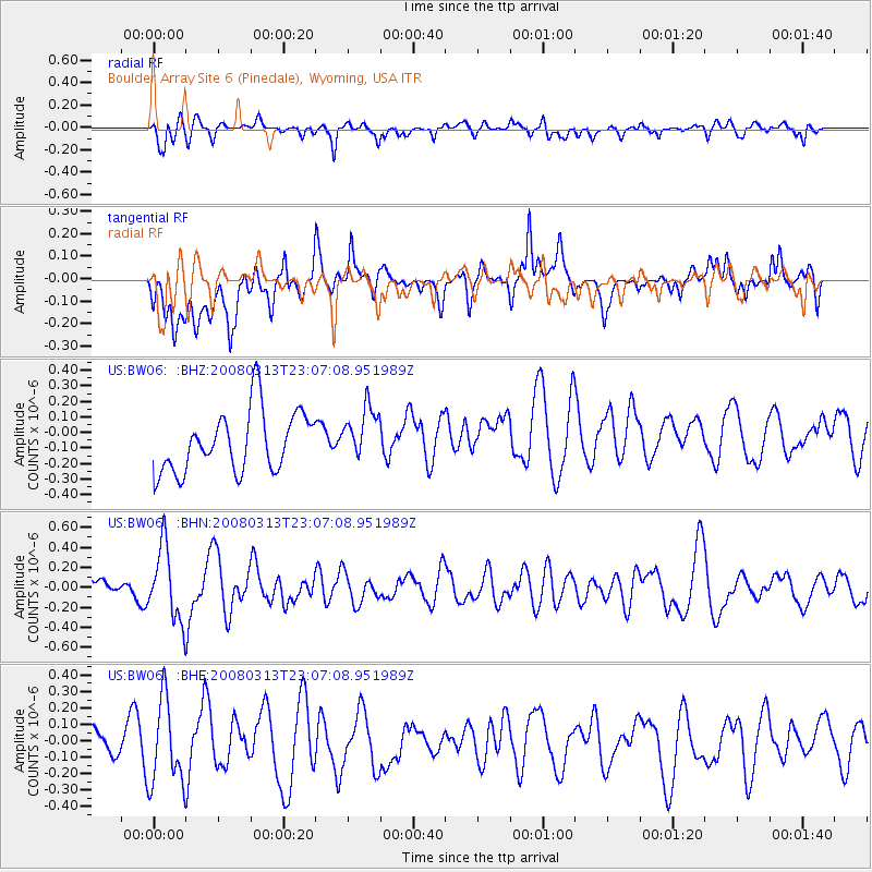
BW06 Boulder Array Site 6 (Pinedale), Wyoming, USA - Earthquake Result Viewer
*The percent match for this event was below the threshold and hence no stack was calculated.
| Earthquake location: |
Near Coast Of Chiapas, Mexico |
| Earthquake latitude/longitude: |
14.5/-93.5 |
| Earthquake time(UTC): |
2008/03/13 (073) 23:01:18 GMT |
| Earthquake Depth: |
10 km |
| Earthquake Magnitude: |
5.7 MW, 5.0 MS, 5.1 MB, 5.5 MW |
| Earthquake Catalog/Contributor: |
WHDF/NEIC |
|
| Network: |
US United States National Seismic Network |
| Station: |
BW06 Boulder Array Site 6 (Pinedale), Wyoming, USA |
| Lat/Lon: |
42.77 N/109.56 W |
| Elevation: |
2224 m |
|
| Distance: |
31.4 deg |
| Az: |
336.949 deg |
| Baz: |
148.997 deg |
| Ray Param: |
$rayparam |
*The percent match for this event was below the threshold and hence was not used in the summary stack. |
|
| Radial Match: |
41.053204 % |
| Radial Bump: |
400 |
| Transverse Match: |
55.79617 % |
| Transverse Bump: |
400 |
| SOD ConfigId: |
2504 |
| Insert Time: |
2010-03-05 03:44:13.773 +0000 |
| GWidth: |
2.5 |
| Max Bumps: |
400 |
| Tol: |
0.001 |
|
Signal To Noise
| Channel | StoN | STA | LTA |
| US:BW06: :BHN:20080313T23:07:08.951989Z | 1.6045206 | 3.6405766E-7 | 2.2689498E-7 |
| US:BW06: :BHE:20080313T23:07:08.951989Z | 2.107866 | 2.553152E-7 | 1.2112497E-7 |
| US:BW06: :BHZ:20080313T23:07:08.951989Z | 0.8702406 | 1.6922148E-7 | 1.9445366E-7 |
| Arrivals |
| Ps | |
| PpPs | |
| PsPs/PpSs | |


