You are here: Home > Network List > UW - Pacific Northwest Regional Seismic Network Stations List
> Station UMAT Pilot Rock, OR, USA > Earthquake Result Viewer
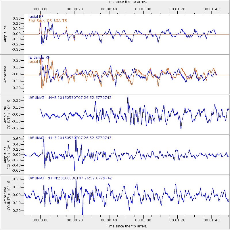
UMAT Pilot Rock, OR, USA - Earthquake Result Viewer
*The percent match for this event was below the threshold and hence no stack was calculated.
| Earthquake location: |
Kermadec Islands, New Zealand |
| Earthquake latitude/longitude: |
-30.4/-177.9 |
| Earthquake time(UTC): |
2016/05/30 (151) 07:14:16 GMT |
| Earthquake Depth: |
32 km |
| Earthquake Magnitude: |
5.7 MWB |
| Earthquake Catalog/Contributor: |
NEIC PDE/NEIC COMCAT |
|
| Network: |
UW Pacific Northwest Regional Seismic Network |
| Station: |
UMAT Pilot Rock, OR, USA |
| Lat/Lon: |
45.29 N/118.96 W |
| Elevation: |
1318 m |
|
| Distance: |
92.4 deg |
| Az: |
37.264 deg |
| Baz: |
227.836 deg |
| Ray Param: |
$rayparam |
*The percent match for this event was below the threshold and hence was not used in the summary stack. |
|
| Radial Match: |
73.982864 % |
| Radial Bump: |
400 |
| Transverse Match: |
65.40596 % |
| Transverse Bump: |
400 |
| SOD ConfigId: |
7422571 |
| Insert Time: |
2019-04-22 16:45:14.345 +0000 |
| GWidth: |
2.5 |
| Max Bumps: |
400 |
| Tol: |
0.001 |
|
Signal To Noise
| Channel | StoN | STA | LTA |
| UW:UMAT: :HHZ:20160530T07:26:52.677974Z | 5.1074896 | 2.1968663E-7 | 4.301264E-8 |
| UW:UMAT: :HHN:20160530T07:26:52.677974Z | 2.045105 | 7.03917E-8 | 3.44196E-8 |
| UW:UMAT: :HHE:20160530T07:26:52.677974Z | 2.7826545 | 7.480522E-8 | 2.6882683E-8 |
| Arrivals |
| Ps | |
| PpPs | |
| PsPs/PpSs | |


