You are here: Home > Network List > UW - Pacific Northwest Regional Seismic Network Stations List
> Station FISH Seaside, OR, USA > Earthquake Result Viewer
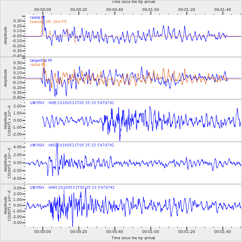
FISH Seaside, OR, USA - Earthquake Result Viewer
*The percent match for this event was below the threshold and hence no stack was calculated.
| Earthquake location: |
Taiwan Region |
| Earthquake latitude/longitude: |
25.6/122.5 |
| Earthquake time(UTC): |
2016/05/31 (152) 05:23:47 GMT |
| Earthquake Depth: |
243 km |
| Earthquake Magnitude: |
6.1 MO |
| Earthquake Catalog/Contributor: |
NEIC PDE/NEIC ALERT |
|
| Network: |
UW Pacific Northwest Regional Seismic Network |
| Station: |
FISH Seaside, OR, USA |
| Lat/Lon: |
45.93 N/123.56 W |
| Elevation: |
325 m |
|
| Distance: |
87.0 deg |
| Az: |
39.704 deg |
| Baz: |
304.242 deg |
| Ray Param: |
$rayparam |
*The percent match for this event was below the threshold and hence was not used in the summary stack. |
|
| Radial Match: |
69.491905 % |
| Radial Bump: |
400 |
| Transverse Match: |
68.04326 % |
| Transverse Bump: |
400 |
| SOD ConfigId: |
7422571 |
| Insert Time: |
2019-04-22 16:55:13.960 +0000 |
| GWidth: |
2.5 |
| Max Bumps: |
400 |
| Tol: |
0.001 |
|
Signal To Noise
| Channel | StoN | STA | LTA |
| UW:FISH: :HHZ:20160531T05:35:33.547974Z | 3.8184094 | 1.0248083E-6 | 2.6838617E-7 |
| UW:FISH: :HHN:20160531T05:35:33.547974Z | 0.98576164 | 4.4070063E-7 | 4.470661E-7 |
| UW:FISH: :HHE:20160531T05:35:33.547974Z | 1.0696647 | 4.1957585E-7 | 3.922499E-7 |
| Arrivals |
| Ps | |
| PpPs | |
| PsPs/PpSs | |


