You are here: Home > Network List > US - United States National Seismic Network Stations List
> Station HAWA Hanford, Washington, USA > Earthquake Result Viewer
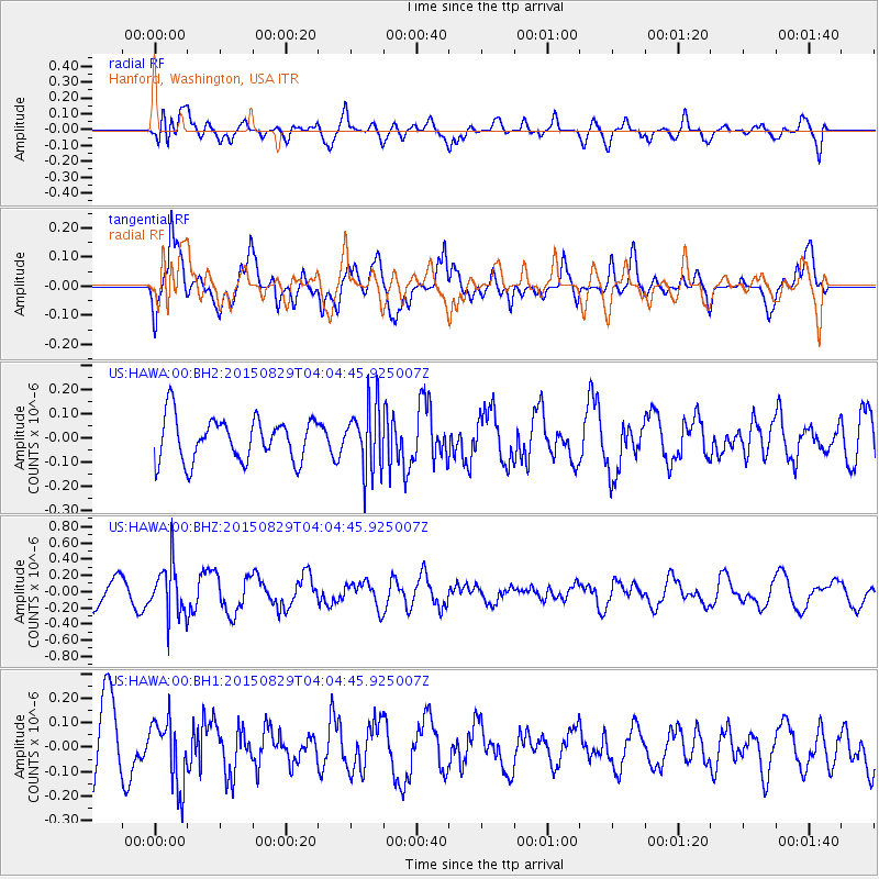
HAWA Hanford, Washington, USA - Earthquake Result Viewer
*The percent match for this event was below the threshold and hence no stack was calculated.
| Earthquake location: |
Mariana Islands |
| Earthquake latitude/longitude: |
19.1/145.7 |
| Earthquake time(UTC): |
2015/08/29 (241) 03:53:23 GMT |
| Earthquake Depth: |
124 km |
| Earthquake Magnitude: |
5.5 MB |
| Earthquake Catalog/Contributor: |
NEIC PDE/NEIC COMCAT |
|
| Network: |
US United States National Seismic Network |
| Station: |
HAWA Hanford, Washington, USA |
| Lat/Lon: |
46.39 N/119.53 W |
| Elevation: |
364 m |
|
| Distance: |
79.6 deg |
| Az: |
44.526 deg |
| Baz: |
286.711 deg |
| Ray Param: |
$rayparam |
*The percent match for this event was below the threshold and hence was not used in the summary stack. |
|
| Radial Match: |
50.08393 % |
| Radial Bump: |
400 |
| Transverse Match: |
66.43766 % |
| Transverse Bump: |
400 |
| SOD ConfigId: |
1085051 |
| Insert Time: |
2015-09-12 04:09:31.424 +0000 |
| GWidth: |
2.5 |
| Max Bumps: |
400 |
| Tol: |
0.001 |
|
Signal To Noise
| Channel | StoN | STA | LTA |
| US:HAWA:00:BHZ:20150829T04:04:45.925007Z | 1.7576721 | 3.1249894E-7 | 1.7779136E-7 |
| US:HAWA:00:BH1:20150829T04:04:45.925007Z | 0.9828333 | 1.3196637E-7 | 1.3427136E-7 |
| US:HAWA:00:BH2:20150829T04:04:45.925007Z | 1.5219978 | 1.357729E-7 | 8.920702E-8 |
| Arrivals |
| Ps | |
| PpPs | |
| PsPs/PpSs | |


