You are here: Home > Network List > US - United States National Seismic Network Stations List
> Station MSO Missoula, Montana, USA > Earthquake Result Viewer
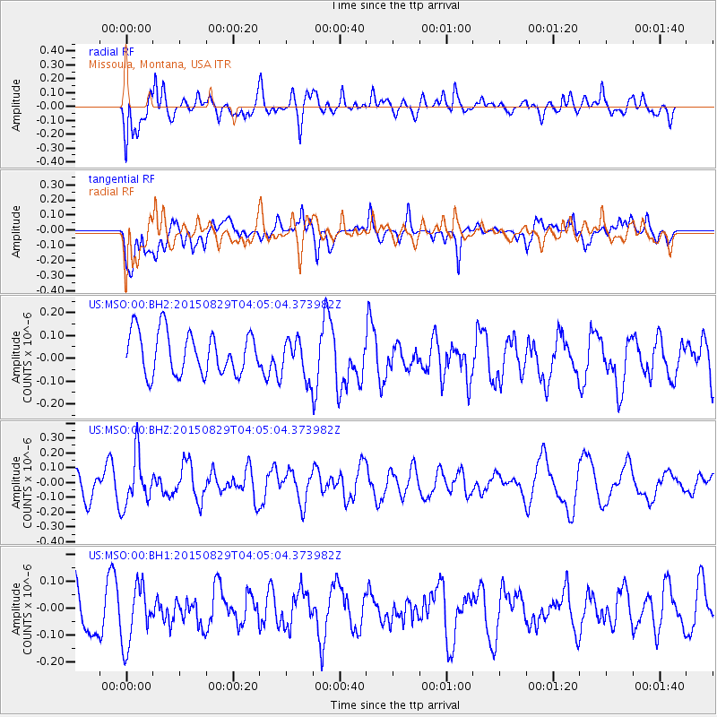
MSO Missoula, Montana, USA - Earthquake Result Viewer
*The percent match for this event was below the threshold and hence no stack was calculated.
| Earthquake location: |
Mariana Islands |
| Earthquake latitude/longitude: |
19.1/145.7 |
| Earthquake time(UTC): |
2015/08/29 (241) 03:53:23 GMT |
| Earthquake Depth: |
124 km |
| Earthquake Magnitude: |
5.5 MB |
| Earthquake Catalog/Contributor: |
NEIC PDE/NEIC COMCAT |
|
| Network: |
US United States National Seismic Network |
| Station: |
MSO Missoula, Montana, USA |
| Lat/Lon: |
46.83 N/113.94 W |
| Elevation: |
1264 m |
|
| Distance: |
83.1 deg |
| Az: |
42.864 deg |
| Baz: |
290.514 deg |
| Ray Param: |
$rayparam |
*The percent match for this event was below the threshold and hence was not used in the summary stack. |
|
| Radial Match: |
57.250504 % |
| Radial Bump: |
400 |
| Transverse Match: |
66.66101 % |
| Transverse Bump: |
400 |
| SOD ConfigId: |
1085051 |
| Insert Time: |
2015-09-12 04:09:52.998 +0000 |
| GWidth: |
2.5 |
| Max Bumps: |
400 |
| Tol: |
0.001 |
|
Signal To Noise
| Channel | StoN | STA | LTA |
| US:MSO:00:BHZ:20150829T04:05:04.373982Z | 1.6905377 | 1.6768382E-7 | 9.918964E-8 |
| US:MSO:00:BH1:20150829T04:05:04.373982Z | 1.5620942 | 1.1465438E-7 | 7.3397864E-8 |
| US:MSO:00:BH2:20150829T04:05:04.373982Z | 0.9545675 | 8.794877E-8 | 9.2134684E-8 |
| Arrivals |
| Ps | |
| PpPs | |
| PsPs/PpSs | |


