You are here: Home > Network List > LD - Lamont-Doherty Cooperative Seismographic Network Stations List
> Station GEDE Greenville, DE, USA > Earthquake Result Viewer
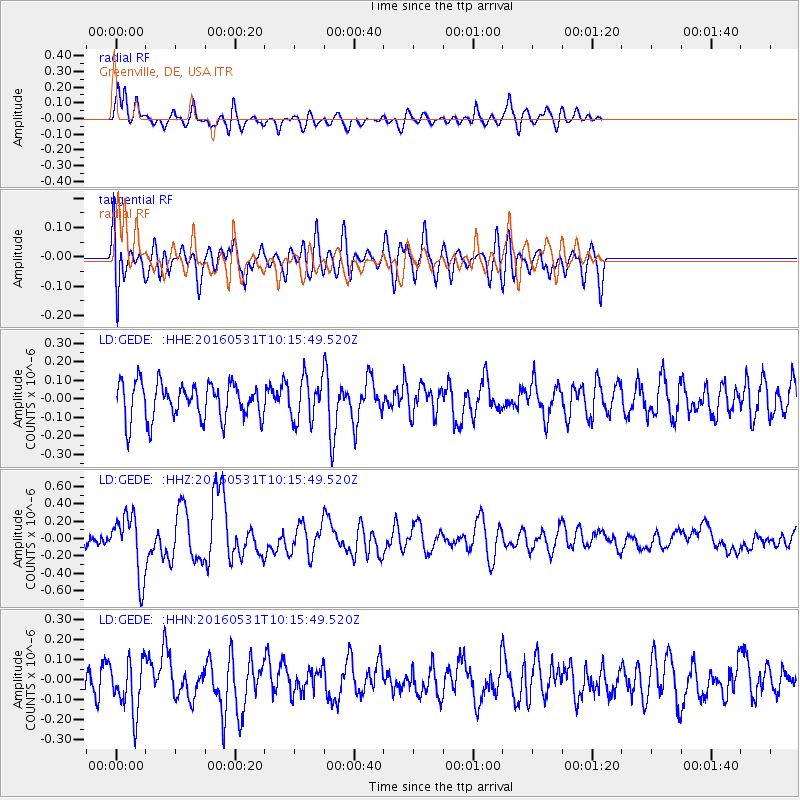
GEDE Greenville, DE, USA - Earthquake Result Viewer
*The percent match for this event was below the threshold and hence no stack was calculated.
| Earthquake location: |
Kuril Islands |
| Earthquake latitude/longitude: |
47.5/154.4 |
| Earthquake time(UTC): |
2016/05/31 (152) 10:03:59 GMT |
| Earthquake Depth: |
10 km |
| Earthquake Magnitude: |
5.5 MB |
| Earthquake Catalog/Contributor: |
NEIC PDE/NEIC COMCAT |
|
| Network: |
LD Lamont-Doherty Cooperative Seismographic Network |
| Station: |
GEDE Greenville, DE, USA |
| Lat/Lon: |
39.81 N/75.64 W |
| Elevation: |
105 m |
|
| Distance: |
82.3 deg |
| Az: |
36.541 deg |
| Baz: |
328.424 deg |
| Ray Param: |
$rayparam |
*The percent match for this event was below the threshold and hence was not used in the summary stack. |
|
| Radial Match: |
55.875378 % |
| Radial Bump: |
400 |
| Transverse Match: |
48.020508 % |
| Transverse Bump: |
400 |
| SOD ConfigId: |
7422571 |
| Insert Time: |
2019-04-22 17:02:42.260 +0000 |
| GWidth: |
2.5 |
| Max Bumps: |
400 |
| Tol: |
0.001 |
|
Signal To Noise
| Channel | StoN | STA | LTA |
| LD:GEDE: :HHZ:20160531T10:15:49.520Z | 3.3737843 | 3.5044994E-7 | 1.03874434E-7 |
| LD:GEDE: :HHN:20160531T10:15:49.520Z | 1.8781471 | 1.3023586E-7 | 6.934273E-8 |
| LD:GEDE: :HHE:20160531T10:15:49.520Z | 1.3179628 | 1.2872661E-7 | 9.7670906E-8 |
| Arrivals |
| Ps | |
| PpPs | |
| PsPs/PpSs | |


