You are here: Home > Network List > WY - Yellowstone Wyoming Seismic Network Stations List
> Station YHH Holmes Hill, YNP, WY, USA > Earthquake Result Viewer
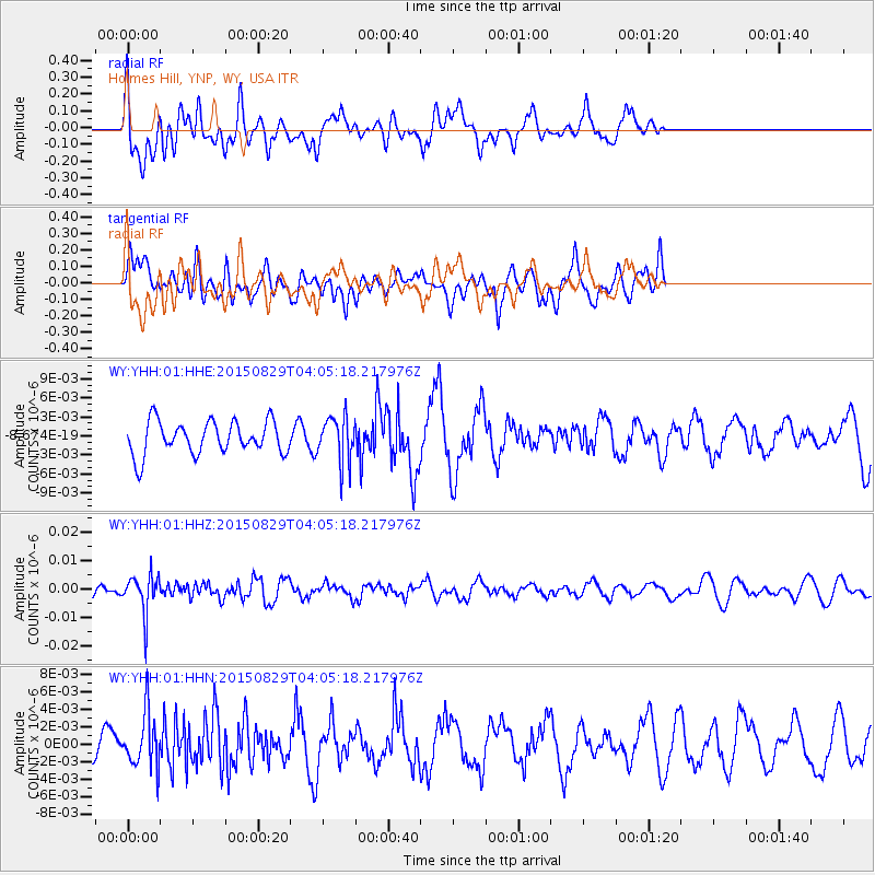
YHH Holmes Hill, YNP, WY, USA - Earthquake Result Viewer
*The percent match for this event was below the threshold and hence no stack was calculated.
| Earthquake location: |
Mariana Islands |
| Earthquake latitude/longitude: |
19.1/145.7 |
| Earthquake time(UTC): |
2015/08/29 (241) 03:53:23 GMT |
| Earthquake Depth: |
124 km |
| Earthquake Magnitude: |
5.5 MB |
| Earthquake Catalog/Contributor: |
NEIC PDE/NEIC COMCAT |
|
| Network: |
WY Yellowstone Wyoming Seismic Network |
| Station: |
YHH Holmes Hill, YNP, WY, USA |
| Lat/Lon: |
44.79 N/110.85 W |
| Elevation: |
2717 m |
|
| Distance: |
85.9 deg |
| Az: |
43.967 deg |
| Baz: |
292.829 deg |
| Ray Param: |
$rayparam |
*The percent match for this event was below the threshold and hence was not used in the summary stack. |
|
| Radial Match: |
60.082005 % |
| Radial Bump: |
400 |
| Transverse Match: |
49.756405 % |
| Transverse Bump: |
400 |
| SOD ConfigId: |
1085051 |
| Insert Time: |
2015-09-12 04:12:12.368 +0000 |
| GWidth: |
2.5 |
| Max Bumps: |
400 |
| Tol: |
0.001 |
|
Signal To Noise
| Channel | StoN | STA | LTA |
| WY:YHH:01:HHZ:20150829T04:05:18.217976Z | 3.1384718 | 6.9804584E-9 | 2.2241582E-9 |
| WY:YHH:01:HHN:20150829T04:05:18.217976Z | 1.1786263 | 3.0887755E-9 | 2.620657E-9 |
| WY:YHH:01:HHE:20150829T04:05:18.217976Z | 1.3554195 | 3.5052916E-9 | 2.5861304E-9 |
| Arrivals |
| Ps | |
| PpPs | |
| PsPs/PpSs | |


