You are here: Home > Network List > TA - USArray Transportable Network (new EarthScope stations) Stations List
> Station J25K Salcha River, AK, USA > Earthquake Result Viewer
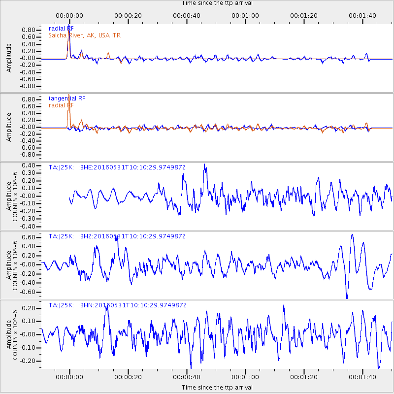
J25K Salcha River, AK, USA - Earthquake Result Viewer
*The percent match for this event was below the threshold and hence no stack was calculated.
| Earthquake location: |
Kuril Islands |
| Earthquake latitude/longitude: |
47.5/154.4 |
| Earthquake time(UTC): |
2016/05/31 (152) 10:03:59 GMT |
| Earthquake Depth: |
10 km |
| Earthquake Magnitude: |
5.5 MB |
| Earthquake Catalog/Contributor: |
NEIC PDE/NEIC COMCAT |
|
| Network: |
TA USArray Transportable Network (new EarthScope stations) |
| Station: |
J25K Salcha River, AK, USA |
| Lat/Lon: |
64.61 N/145.37 W |
| Elevation: |
949 m |
|
| Distance: |
36.0 deg |
| Az: |
39.508 deg |
| Baz: |
271.358 deg |
| Ray Param: |
$rayparam |
*The percent match for this event was below the threshold and hence was not used in the summary stack. |
|
| Radial Match: |
76.81027 % |
| Radial Bump: |
400 |
| Transverse Match: |
53.049816 % |
| Transverse Bump: |
400 |
| SOD ConfigId: |
7422571 |
| Insert Time: |
2019-04-22 17:07:03.607 +0000 |
| GWidth: |
2.5 |
| Max Bumps: |
400 |
| Tol: |
0.001 |
|
Signal To Noise
| Channel | StoN | STA | LTA |
| TA:J25K: :BHZ:20160531T10:10:29.974987Z | 2.436197 | 1.357623E-7 | 5.5727146E-8 |
| TA:J25K: :BHN:20160531T10:10:29.974987Z | 0.8135299 | 4.0200476E-8 | 4.9414872E-8 |
| TA:J25K: :BHE:20160531T10:10:29.974987Z | 1.457501 | 8.442549E-8 | 5.792482E-8 |
| Arrivals |
| Ps | |
| PpPs | |
| PsPs/PpSs | |


