You are here: Home > Network List > US - United States National Seismic Network Stations List
> Station AHID Auburn Hatchery, Idaho, USA > Earthquake Result Viewer
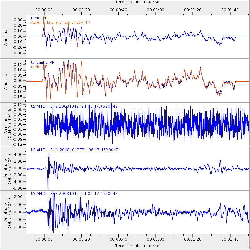
AHID Auburn Hatchery, Idaho, USA - Earthquake Result Viewer
*The percent match for this event was below the threshold and hence no stack was calculated.
| Earthquake location: |
Southern Bolivia |
| Earthquake latitude/longitude: |
-20.1/-65.0 |
| Earthquake time(UTC): |
2008/10/12 (286) 20:55:41 GMT |
| Earthquake Depth: |
353 km |
| Earthquake Magnitude: |
6.0 MB, 6.2 MW, 6.2 MW |
| Earthquake Catalog/Contributor: |
WHDF/NEIC |
|
| Network: |
US United States National Seismic Network |
| Station: |
AHID Auburn Hatchery, Idaho, USA |
| Lat/Lon: |
42.77 N/111.10 W |
| Elevation: |
1960 m |
|
| Distance: |
75.6 deg |
| Az: |
326.768 deg |
| Baz: |
135.628 deg |
| Ray Param: |
$rayparam |
*The percent match for this event was below the threshold and hence was not used in the summary stack. |
|
| Radial Match: |
67.69139 % |
| Radial Bump: |
400 |
| Transverse Match: |
67.519844 % |
| Transverse Bump: |
400 |
| SOD ConfigId: |
2556 |
| Insert Time: |
2010-03-05 04:03:24.209 +0000 |
| GWidth: |
2.5 |
| Max Bumps: |
400 |
| Tol: |
0.001 |
|
Signal To Noise
| Channel | StoN | STA | LTA |
| US:AHID: :BHN:20081012T21:06:17.452004Z | 17.569847 | 1.6782101E-6 | 9.5516484E-8 |
| US:AHID: :BHE:20081012T21:06:17.452004Z | 5.5627437 | 9.734288E-7 | 1.7499075E-7 |
| US:AHID: :BHZ:20081012T21:06:17.452004Z | 1.1176225 | 4.610774E-8 | 4.1255202E-8 |
| Arrivals |
| Ps | |
| PpPs | |
| PsPs/PpSs | |


