You are here: Home > Network List > TA - USArray Transportable Network (new EarthScope stations) Stations List
> Station W41B Gary Mavity, Velonia, AR, USA > Earthquake Result Viewer
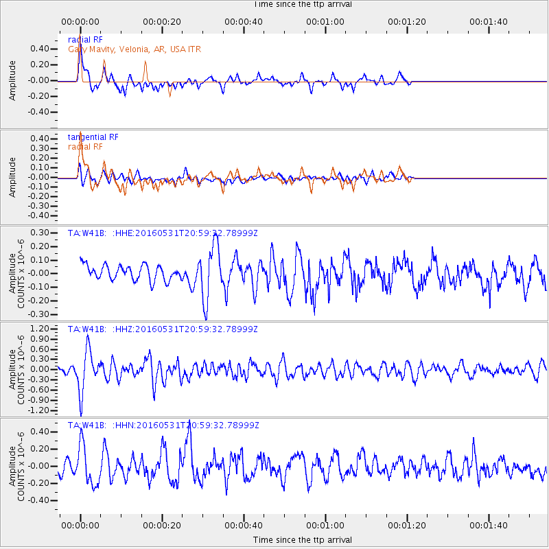
W41B Gary Mavity, Velonia, AR, USA - Earthquake Result Viewer
*The percent match for this event was below the threshold and hence no stack was calculated.
| Earthquake location: |
Alaska Peninsula |
| Earthquake latitude/longitude: |
55.4/-158.5 |
| Earthquake time(UTC): |
2016/05/31 (152) 20:51:22 GMT |
| Earthquake Depth: |
39 km |
| Earthquake Magnitude: |
5.7 MWW, 5.4 MI, 5.7 MWC, 5.8 MB, 5.8 MWB |
| Earthquake Catalog/Contributor: |
NEIC PDE/NEIC COMCAT |
|
| Network: |
TA USArray Transportable Network (new EarthScope stations) |
| Station: |
W41B Gary Mavity, Velonia, AR, USA |
| Lat/Lon: |
35.17 N/92.25 W |
| Elevation: |
95 m |
|
| Distance: |
48.8 deg |
| Az: |
85.732 deg |
| Baz: |
316.077 deg |
| Ray Param: |
$rayparam |
*The percent match for this event was below the threshold and hence was not used in the summary stack. |
|
| Radial Match: |
71.62917 % |
| Radial Bump: |
400 |
| Transverse Match: |
53.34855 % |
| Transverse Bump: |
400 |
| SOD ConfigId: |
7422571 |
| Insert Time: |
2019-04-22 17:22:37.960 +0000 |
| GWidth: |
2.5 |
| Max Bumps: |
400 |
| Tol: |
0.001 |
|
Signal To Noise
| Channel | StoN | STA | LTA |
| TA:W41B: :HHZ:20160531T20:59:32.78999Z | 7.8401413 | 6.1235323E-7 | 7.810487E-8 |
| TA:W41B: :HHN:20160531T20:59:32.78999Z | 3.0551605 | 2.330542E-7 | 7.628215E-8 |
| TA:W41B: :HHE:20160531T20:59:32.78999Z | 3.7347977 | 2.0124624E-7 | 5.3884108E-8 |
| Arrivals |
| Ps | |
| PpPs | |
| PsPs/PpSs | |


