You are here: Home > Network List > GS - US Geological Survey Networks Stations List
> Station KAN08 Pence Farm, Harper, KS, USA > Earthquake Result Viewer
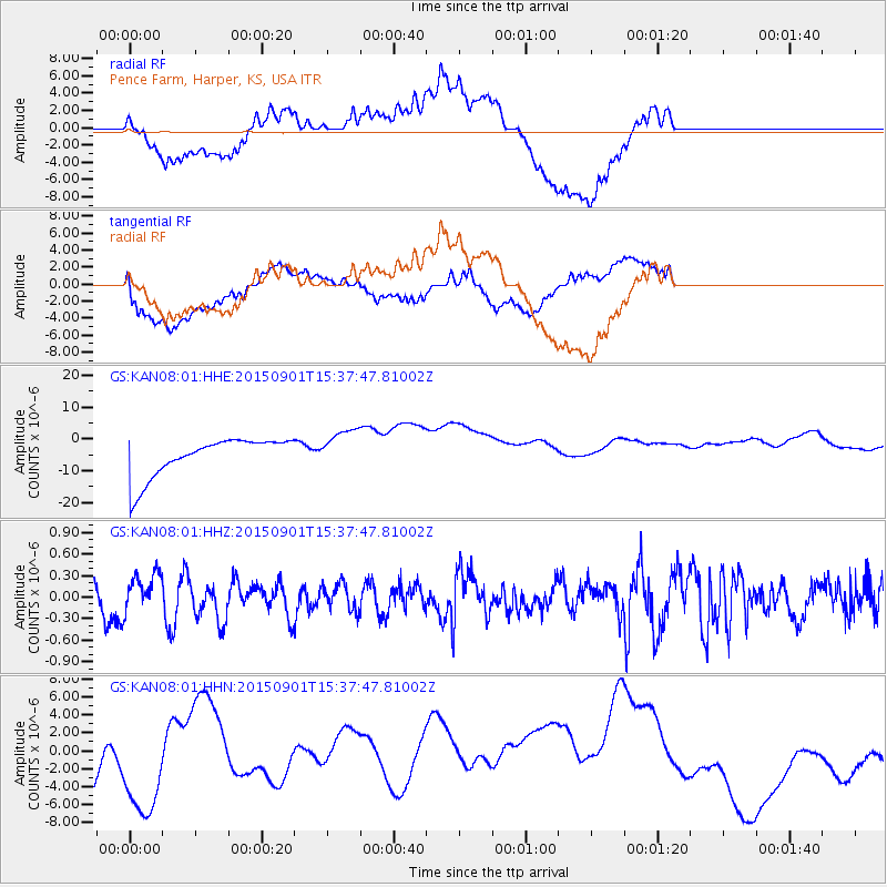
KAN08 Pence Farm, Harper, KS, USA - Earthquake Result Viewer
*The percent match for this event was below the threshold and hence no stack was calculated.
| Earthquake location: |
Southeast Of Honshu, Japan |
| Earthquake latitude/longitude: |
31.2/141.6 |
| Earthquake time(UTC): |
2015/09/01 (244) 15:25:10 GMT |
| Earthquake Depth: |
13 km |
| Earthquake Magnitude: |
5.6 MB |
| Earthquake Catalog/Contributor: |
NEIC PDE/NEIC COMCAT |
|
| Network: |
GS US Geological Survey Networks |
| Station: |
KAN08 Pence Farm, Harper, KS, USA |
| Lat/Lon: |
37.23 N/97.97 W |
| Elevation: |
375 m |
|
| Distance: |
92.1 deg |
| Az: |
43.522 deg |
| Baz: |
312.3 deg |
| Ray Param: |
$rayparam |
*The percent match for this event was below the threshold and hence was not used in the summary stack. |
|
| Radial Match: |
39.80236 % |
| Radial Bump: |
400 |
| Transverse Match: |
39.591938 % |
| Transverse Bump: |
400 |
| SOD ConfigId: |
1085051 |
| Insert Time: |
2015-09-15 15:44:38.708 +0000 |
| GWidth: |
2.5 |
| Max Bumps: |
400 |
| Tol: |
0.001 |
|
Signal To Noise
| Channel | StoN | STA | LTA |
| GS:KAN08:01:HHZ:20150901T15:37:47.81002Z | 1.5435225 | 2.6532493E-7 | 1.7189573E-7 |
| GS:KAN08:01:HHN:20150901T15:37:47.81002Z | 1.2123481 | 5.9896465E-6 | 4.9405335E-6 |
| GS:KAN08:01:HHE:20150901T15:37:47.81002Z | 1.0694389 | 6.5252475E-6 | 6.101561E-6 |
| Arrivals |
| Ps | |
| PpPs | |
| PsPs/PpSs | |


