You are here: Home > Network List > GS - US Geological Survey Networks Stations List
> Station KAN10 Keim Farm, Anthony, KS, USA > Earthquake Result Viewer
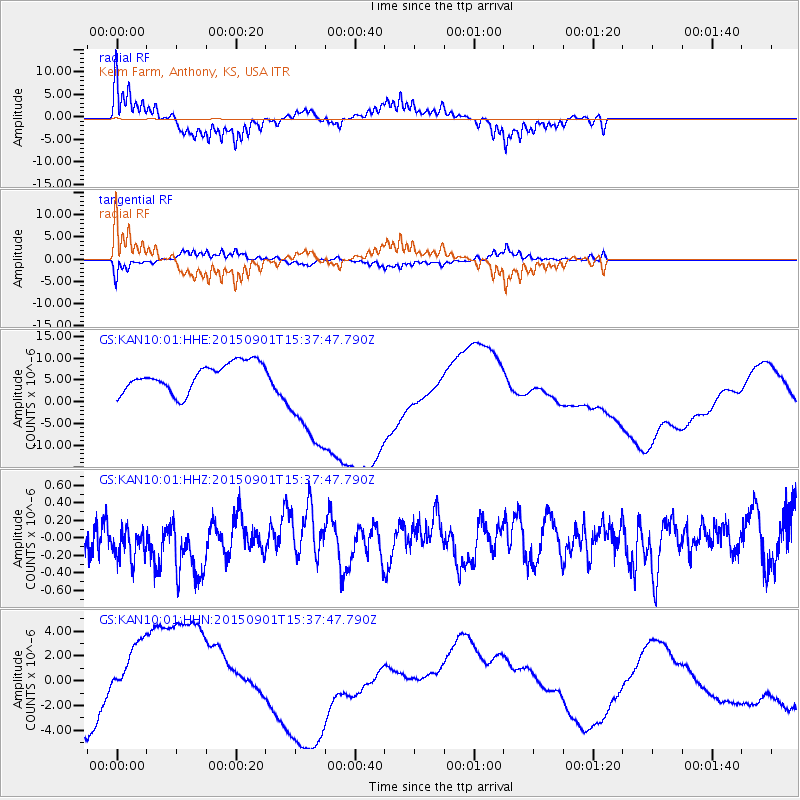
KAN10 Keim Farm, Anthony, KS, USA - Earthquake Result Viewer
*The percent match for this event was below the threshold and hence no stack was calculated.
| Earthquake location: |
Southeast Of Honshu, Japan |
| Earthquake latitude/longitude: |
31.2/141.6 |
| Earthquake time(UTC): |
2015/09/01 (244) 15:25:10 GMT |
| Earthquake Depth: |
13 km |
| Earthquake Magnitude: |
5.6 MB |
| Earthquake Catalog/Contributor: |
NEIC PDE/NEIC COMCAT |
|
| Network: |
GS US Geological Survey Networks |
| Station: |
KAN10 Keim Farm, Anthony, KS, USA |
| Lat/Lon: |
37.12 N/98.10 W |
| Elevation: |
417 m |
|
| Distance: |
92.1 deg |
| Az: |
43.665 deg |
| Baz: |
312.22 deg |
| Ray Param: |
$rayparam |
*The percent match for this event was below the threshold and hence was not used in the summary stack. |
|
| Radial Match: |
76.08431 % |
| Radial Bump: |
351 |
| Transverse Match: |
59.57599 % |
| Transverse Bump: |
306 |
| SOD ConfigId: |
1085051 |
| Insert Time: |
2015-09-15 15:44:44.294 +0000 |
| GWidth: |
2.5 |
| Max Bumps: |
400 |
| Tol: |
0.001 |
|
Signal To Noise
| Channel | StoN | STA | LTA |
| GS:KAN10:01:HHZ:20150901T15:37:47.790Z | 0.7394247 | 2.015008E-7 | 2.7251025E-7 |
| GS:KAN10:01:HHN:20150901T15:37:47.790Z | 1.6883141 | 3.5356188E-6 | 2.0941714E-6 |
| GS:KAN10:01:HHE:20150901T15:37:47.790Z | 3.8574984 | 1.2440358E-5 | 3.2249807E-6 |
| Arrivals |
| Ps | |
| PpPs | |
| PsPs/PpSs | |


