You are here: Home > Network List > IU - Global Seismograph Network (GSN - IRIS/USGS) Stations List
> Station CCM Cathedral Cave, Missouri, USA > Earthquake Result Viewer
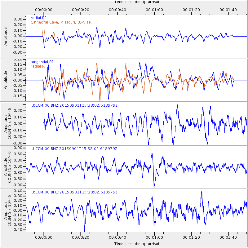
CCM Cathedral Cave, Missouri, USA - Earthquake Result Viewer
*The percent match for this event was below the threshold and hence no stack was calculated.
| Earthquake location: |
Southeast Of Honshu, Japan |
| Earthquake latitude/longitude: |
31.2/141.6 |
| Earthquake time(UTC): |
2015/09/01 (244) 15:25:10 GMT |
| Earthquake Depth: |
13 km |
| Earthquake Magnitude: |
5.6 MB |
| Earthquake Catalog/Contributor: |
NEIC PDE/NEIC COMCAT |
|
| Network: |
IU Global Seismograph Network (GSN - IRIS/USGS) |
| Station: |
CCM Cathedral Cave, Missouri, USA |
| Lat/Lon: |
38.06 N/91.24 W |
| Elevation: |
222 m |
|
| Distance: |
95.3 deg |
| Az: |
39.183 deg |
| Baz: |
316.675 deg |
| Ray Param: |
$rayparam |
*The percent match for this event was below the threshold and hence was not used in the summary stack. |
|
| Radial Match: |
59.561344 % |
| Radial Bump: |
400 |
| Transverse Match: |
53.82042 % |
| Transverse Bump: |
400 |
| SOD ConfigId: |
1085051 |
| Insert Time: |
2015-09-15 15:46:07.160 +0000 |
| GWidth: |
2.5 |
| Max Bumps: |
400 |
| Tol: |
0.001 |
|
Signal To Noise
| Channel | StoN | STA | LTA |
| IU:CCM:00:BHZ:20150901T15:38:02.618979Z | 1.2518471 | 1.3021995E-7 | 1.0402224E-7 |
| IU:CCM:00:BH1:20150901T15:38:02.618979Z | 0.83289814 | 8.5772285E-8 | 1.0298052E-7 |
| IU:CCM:00:BH2:20150901T15:38:02.618979Z | 0.94246966 | 7.120722E-8 | 7.555385E-8 |
| Arrivals |
| Ps | |
| PpPs | |
| PsPs/PpSs | |


