You are here: Home > Network List > UW - Pacific Northwest Regional Seismic Network Stations List
> Station LEBA Lebam, WA, USA > Earthquake Result Viewer
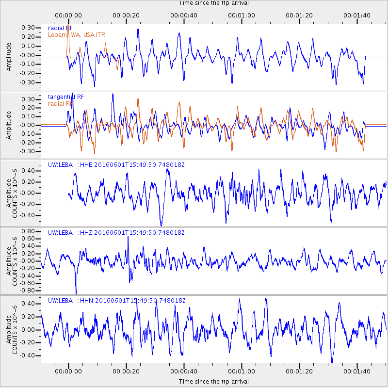
LEBA Lebam, WA, USA - Earthquake Result Viewer
*The percent match for this event was below the threshold and hence no stack was calculated.
| Earthquake location: |
Kermadec Islands, New Zealand |
| Earthquake latitude/longitude: |
-30.2/-178.0 |
| Earthquake time(UTC): |
2016/06/01 (153) 15:37:23 GMT |
| Earthquake Depth: |
44 km |
| Earthquake Magnitude: |
5.5 MWC, 5.5 MWC |
| Earthquake Catalog/Contributor: |
NEIC PDE/NEIC COMCAT |
|
| Network: |
UW Pacific Northwest Regional Seismic Network |
| Station: |
LEBA Lebam, WA, USA |
| Lat/Lon: |
46.55 N/123.56 W |
| Elevation: |
73 m |
|
| Distance: |
90.8 deg |
| Az: |
34.139 deg |
| Baz: |
224.73 deg |
| Ray Param: |
$rayparam |
*The percent match for this event was below the threshold and hence was not used in the summary stack. |
|
| Radial Match: |
59.8528 % |
| Radial Bump: |
400 |
| Transverse Match: |
55.250645 % |
| Transverse Bump: |
400 |
| SOD ConfigId: |
7422571 |
| Insert Time: |
2019-04-22 17:31:15.178 +0000 |
| GWidth: |
2.5 |
| Max Bumps: |
400 |
| Tol: |
0.001 |
|
Signal To Noise
| Channel | StoN | STA | LTA |
| UW:LEBA: :HHZ:20160601T15:49:50.748018Z | 2.4681182 | 2.6112434E-7 | 1.0579897E-7 |
| UW:LEBA: :HHN:20160601T15:49:50.748018Z | 0.7377454 | 1.0988762E-7 | 1.489506E-7 |
| UW:LEBA: :HHE:20160601T15:49:50.748018Z | 2.1244931 | 2.9759434E-7 | 1.4007782E-7 |
| Arrivals |
| Ps | |
| PpPs | |
| PsPs/PpSs | |


