You are here: Home > Network List > US - United States National Seismic Network Stations List
> Station AGMN Agassiz National Wildlife Refuge, Minnesota, USA > Earthquake Result Viewer
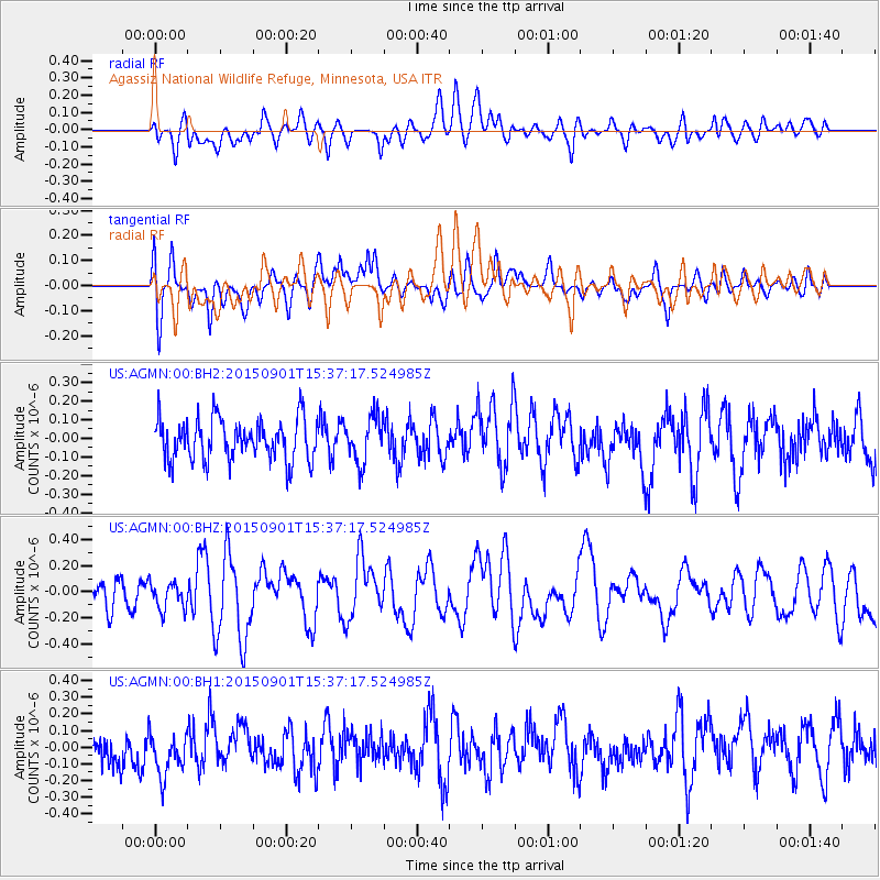
AGMN Agassiz National Wildlife Refuge, Minnesota, USA - Earthquake Result Viewer
*The percent match for this event was below the threshold and hence no stack was calculated.
| Earthquake location: |
Southeast Of Honshu, Japan |
| Earthquake latitude/longitude: |
31.2/141.6 |
| Earthquake time(UTC): |
2015/09/01 (244) 15:25:10 GMT |
| Earthquake Depth: |
13 km |
| Earthquake Magnitude: |
5.6 MB |
| Earthquake Catalog/Contributor: |
NEIC PDE/NEIC COMCAT |
|
| Network: |
US United States National Seismic Network |
| Station: |
AGMN Agassiz National Wildlife Refuge, Minnesota, USA |
| Lat/Lon: |
48.30 N/95.86 W |
| Elevation: |
351 m |
|
| Distance: |
85.7 deg |
| Az: |
34.365 deg |
| Baz: |
313.556 deg |
| Ray Param: |
$rayparam |
*The percent match for this event was below the threshold and hence was not used in the summary stack. |
|
| Radial Match: |
47.683506 % |
| Radial Bump: |
400 |
| Transverse Match: |
55.220085 % |
| Transverse Bump: |
400 |
| SOD ConfigId: |
1085051 |
| Insert Time: |
2015-09-15 15:49:23.224 +0000 |
| GWidth: |
2.5 |
| Max Bumps: |
400 |
| Tol: |
0.001 |
|
Signal To Noise
| Channel | StoN | STA | LTA |
| US:AGMN:00:BHZ:20150901T15:37:17.524985Z | 0.8284838 | 1.069702E-7 | 1.2911562E-7 |
| US:AGMN:00:BH1:20150901T15:37:17.524985Z | 1.1845477 | 1.4109713E-7 | 1.1911477E-7 |
| US:AGMN:00:BH2:20150901T15:37:17.524985Z | 1.0829445 | 1.204273E-7 | 1.1120358E-7 |
| Arrivals |
| Ps | |
| PpPs | |
| PsPs/PpSs | |


