TOO Toolangi, Victoria - Earthquake Result Viewer
Earthquake location: Southern Sumatra, Indonesia
Earthquake latitude/longitude: -2.1/100.7
Earthquake time(UTC): 2016/06/01 (153) 22:56:00 GMT
Earthquake Depth: 50 km
Earthquake Magnitude: 6.6 MWW, 6.4 MWB, 6.6 MWC, 6.7 MWC
Earthquake Catalog/Contributor: NEIC PDE/NEIC COMCAT
Network: AU Australian Seismological Centre
Station: TOO Toolangi, Victoria
Lat/Lon: 37.57 S/145.49 E
Elevation: 604 m
Distance: 54.2 deg
Az: 136.312 deg
Baz: 299.687 deg
Ray Param: 0.06548929
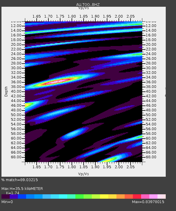
Estimated Moho Depth: 35.5 km
Estimated Crust Vp/Vs: 1.74
Assumed Crust Vp: 6.577 km/s
Estimated Crust Vs: 3.78 km/s
Estimated Crust Poisson's Ratio: 0.25
Radial Match: 89.03215 %
Radial Bump: 400
Transverse Match: 58.024704 %
Transverse Bump: 400
SOD ConfigId: 7422571
Insert Time: 2019-04-22 17:34:35.517 +0000
GWidth: 2.5
Max Bumps: 400
Tol: 0.001

Signal To Noise

ChannelStoNSTALTA
AU:TOO: :BHZ:20160601T23:04:50.519028Z3.98477672.8144186E-67.0629267E-7
AU:TOO: :BHN:20160601T23:04:50.519028Z1.33752356.3375217E-74.738251E-7
AU:TOO: :BHE:20160601T23:04:50.519028Z3.34465531.0739686E-63.2109995E-7
Arrivals
Ps4.2 SECOND
PpPs14 SECOND
PsPs/PpSs18 SECOND