KBK KN.KBK - Earthquake Result Viewer
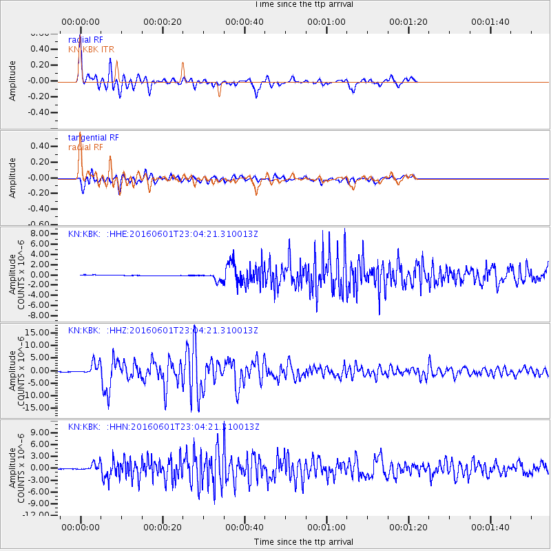
Earthquake location: Southern Sumatra, Indonesia
Earthquake latitude/longitude: -2.1/100.7
Earthquake time(UTC): 2016/06/01 (153) 22:56:00 GMT
Earthquake Depth: 50 km
Earthquake Magnitude: 6.6 MWW, 6.4 MWB, 6.6 MWC, 6.7 MWC
Earthquake Catalog/Contributor: NEIC PDE/NEIC COMCAT
Network: KN Kyrgyz Seismic Telemetry Network
Station: KBK KN.KBK
Lat/Lon: 42.66 N/74.95 E
Elevation: 1760 m
Distance: 50.2 deg
Az: 335.385 deg
Baz: 145.65 deg
Ray Param: 0.068064325
Estimated Moho Depth: 17.5 km
Estimated Crust Vp/Vs: 1.83
Assumed Crust Vp: 6.306 km/s
Estimated Crust Vs: 3.451 km/s
Estimated Crust Poisson's Ratio: 0.29
Radial Match: 93.844025 %
Radial Bump: 351
Transverse Match: 92.63076 %
Transverse Bump: 400
SOD ConfigId: 7422571
Insert Time: 2019-04-22 17:36:17.964 +0000
GWidth: 2.5
Max Bumps: 400
Tol: 0.001

Signal To Noise

ChannelStoNSTALTA
KN:KBK: :HHZ:20160601T23:04:21.310013Z72.166922.4972867E-63.4604312E-8
KN:KBK: :HHN:20160601T23:04:21.310013Z20.181129.544938E-74.7296375E-8
KN:KBK: :HHE:20160601T23:04:21.310013Z10.3404047.860909E-77.60213E-8
Arrivals
Ps2.4 SECOND
PpPs7.4 SECOND
PsPs/PpSs9.9 SECOND