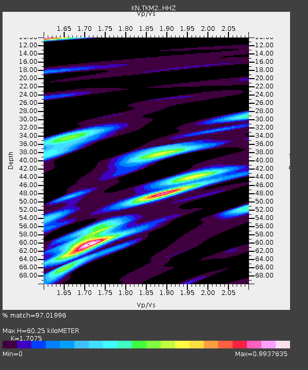
TKM2 - - Earthquake Result Viewer
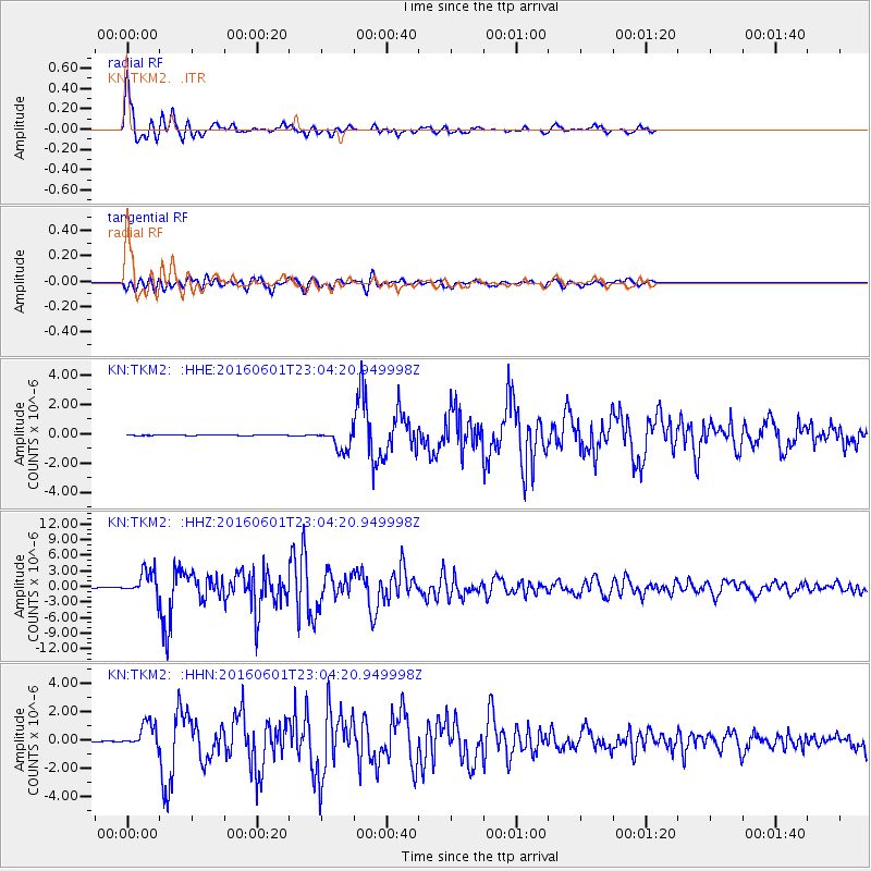
Earthquake location: Southern Sumatra, Indonesia
Earthquake latitude/longitude: -2.1/100.7
Earthquake time(UTC): 2016/06/01 (153) 22:56:00 GMT
Earthquake Depth: 50 km
Earthquake Magnitude: 6.6 MWW, 6.4 MWB, 6.6 MWC, 6.7 MWC
Earthquake Catalog/Contributor: NEIC PDE/NEIC COMCAT
Network: KN Kyrgyz Seismic Telemetry Network
Station: TKM2 -
Lat/Lon: 42.92 N/75.60 E
Elevation: 2020 m
Distance: 50.2 deg
Az: 336.093 deg
Baz: 146.542 deg
Ray Param: 0.06809585
Estimated Moho Depth: 60.25 km
Estimated Crust Vp/Vs: 1.71
Assumed Crust Vp: 6.306 km/s
Estimated Crust Vs: 3.693 km/s
Estimated Crust Poisson's Ratio: 0.24
Radial Match: 97.01996 %
Radial Bump: 400
Transverse Match: 89.28282 %
Transverse Bump: 400
SOD ConfigId: 7422571
Insert Time: 2019-04-22 17:36:21.507 +0000
GWidth: 2.5
Max Bumps: 400
Tol: 0.001

Signal To Noise

ChannelStoNSTALTA
KN:TKM2: :HHZ:20160601T23:04:20.949998Z69.66722.3649272E-63.3946062E-8
KN:TKM2: :HHN:20160601T23:04:20.949998Z38.1505558.6079194E-72.2563025E-8
KN:TKM2: :HHE:20160601T23:04:20.949998Z34.5150767.390263E-72.1411697E-8
Arrivals
Ps7.2 SECOND
PpPs24 SECOND
PsPs/PpSs32 SECOND