You are here: Home > Network List > TA - USArray Transportable Network (new EarthScope stations) Stations List
> Station Z41A Richland Creek Farm, El Dorado, AR, USA > Earthquake Result Viewer
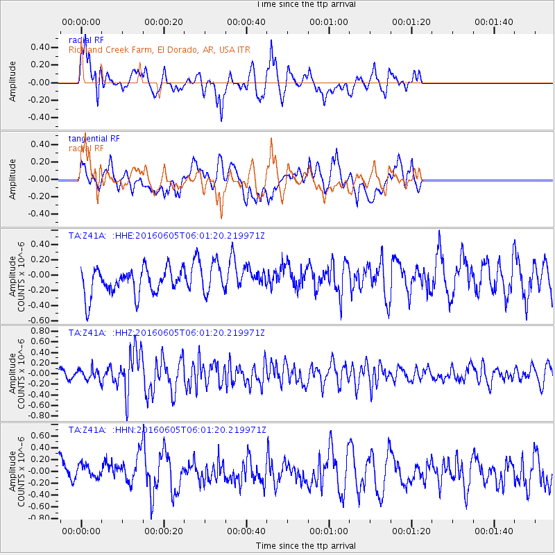
Z41A Richland Creek Farm, El Dorado, AR, USA - Earthquake Result Viewer
*The percent match for this event was below the threshold and hence no stack was calculated.
| Earthquake location: |
Near Coast Of Central Chile |
| Earthquake latitude/longitude: |
-29.4/-71.9 |
| Earthquake time(UTC): |
2016/06/05 (157) 05:51:09 GMT |
| Earthquake Depth: |
15 km |
| Earthquake Magnitude: |
5.7 MWP |
| Earthquake Catalog/Contributor: |
NEIC PDE/NEIC COMCAT |
|
| Network: |
TA USArray Transportable Network (new EarthScope stations) |
| Station: |
Z41A Richland Creek Farm, El Dorado, AR, USA |
| Lat/Lon: |
33.26 N/92.80 W |
| Elevation: |
62 m |
|
| Distance: |
65.3 deg |
| Az: |
340.804 deg |
| Baz: |
159.965 deg |
| Ray Param: |
$rayparam |
*The percent match for this event was below the threshold and hence was not used in the summary stack. |
|
| Radial Match: |
70.800674 % |
| Radial Bump: |
348 |
| Transverse Match: |
50.900948 % |
| Transverse Bump: |
400 |
| SOD ConfigId: |
7422571 |
| Insert Time: |
2019-04-22 17:56:06.430 +0000 |
| GWidth: |
2.5 |
| Max Bumps: |
400 |
| Tol: |
0.001 |
|
Signal To Noise
| Channel | StoN | STA | LTA |
| TA:Z41A: :HHZ:20160605T06:01:20.219971Z | 1.5999619 | 1.027116E-7 | 6.419628E-8 |
| TA:Z41A: :HHN:20160605T06:01:20.219971Z | 0.7803706 | 1.458785E-7 | 1.8693488E-7 |
| TA:Z41A: :HHE:20160605T06:01:20.219971Z | 1.2583568 | 2.1171113E-7 | 1.6824411E-7 |
| Arrivals |
| Ps | |
| PpPs | |
| PsPs/PpSs | |


