You are here: Home > Network List > TA - USArray Transportable Network (new EarthScope stations) Stations List
> Station J25K Salcha River, AK, USA > Earthquake Result Viewer
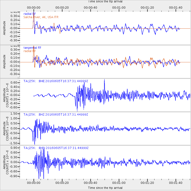
J25K Salcha River, AK, USA - Earthquake Result Viewer
*The percent match for this event was below the threshold and hence no stack was calculated.
| Earthquake location: |
Banda Sea |
| Earthquake latitude/longitude: |
-4.6/125.6 |
| Earthquake time(UTC): |
2016/06/05 (157) 16:25:33 GMT |
| Earthquake Depth: |
429 km |
| Earthquake Magnitude: |
6.3 MWB |
| Earthquake Catalog/Contributor: |
NEIC PDE/NEIC COMCAT |
|
| Network: |
TA USArray Transportable Network (new EarthScope stations) |
| Station: |
J25K Salcha River, AK, USA |
| Lat/Lon: |
64.61 N/145.37 W |
| Elevation: |
949 m |
|
| Distance: |
93.7 deg |
| Az: |
25.589 deg |
| Baz: |
267.14 deg |
| Ray Param: |
$rayparam |
*The percent match for this event was below the threshold and hence was not used in the summary stack. |
|
| Radial Match: |
66.63511 % |
| Radial Bump: |
400 |
| Transverse Match: |
65.205025 % |
| Transverse Bump: |
400 |
| SOD ConfigId: |
7422571 |
| Insert Time: |
2019-04-22 18:02:48.822 +0000 |
| GWidth: |
2.5 |
| Max Bumps: |
400 |
| Tol: |
0.001 |
|
Signal To Noise
| Channel | StoN | STA | LTA |
| TA:J25K: :BHZ:20160605T16:37:31.44999Z | 11.629328 | 6.4044656E-7 | 5.5071677E-8 |
| TA:J25K: :BHN:20160605T16:37:31.44999Z | 11.583727 | 3.6796774E-7 | 3.1765918E-8 |
| TA:J25K: :BHE:20160605T16:37:31.44999Z | 7.2390814 | 2.98001E-7 | 4.116558E-8 |
| Arrivals |
| Ps | |
| PpPs | |
| PsPs/PpSs | |


