You are here: Home > Network List > TA - USArray Transportable Network (new EarthScope stations) Stations List
> Station O17K Koliganek, Bristol Bay, AK, USA > Earthquake Result Viewer
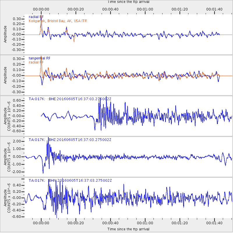
O17K Koliganek, Bristol Bay, AK, USA - Earthquake Result Viewer
*The percent match for this event was below the threshold and hence no stack was calculated.
| Earthquake location: |
Banda Sea |
| Earthquake latitude/longitude: |
-4.6/125.6 |
| Earthquake time(UTC): |
2016/06/05 (157) 16:25:33 GMT |
| Earthquake Depth: |
429 km |
| Earthquake Magnitude: |
6.3 MWB |
| Earthquake Catalog/Contributor: |
NEIC PDE/NEIC COMCAT |
|
| Network: |
TA USArray Transportable Network (new EarthScope stations) |
| Station: |
O17K Koliganek, Bristol Bay, AK, USA |
| Lat/Lon: |
59.77 N/157.09 W |
| Elevation: |
156 m |
|
| Distance: |
87.6 deg |
| Az: |
29.603 deg |
| Baz: |
256.724 deg |
| Ray Param: |
$rayparam |
*The percent match for this event was below the threshold and hence was not used in the summary stack. |
|
| Radial Match: |
70.18307 % |
| Radial Bump: |
400 |
| Transverse Match: |
61.93231 % |
| Transverse Bump: |
400 |
| SOD ConfigId: |
7422571 |
| Insert Time: |
2019-04-22 18:03:14.508 +0000 |
| GWidth: |
2.5 |
| Max Bumps: |
400 |
| Tol: |
0.001 |
|
Signal To Noise
| Channel | StoN | STA | LTA |
| TA:O17K: :BHZ:20160605T16:37:03.275002Z | 13.884171 | 1.0767485E-6 | 7.755224E-8 |
| TA:O17K: :BHN:20160605T16:37:03.275002Z | 2.4278536 | 2.2921935E-7 | 9.441234E-8 |
| TA:O17K: :BHE:20160605T16:37:03.275002Z | 4.0410857 | 2.997065E-7 | 7.4164845E-8 |
| Arrivals |
| Ps | |
| PpPs | |
| PsPs/PpSs | |


