You are here: Home > Network List > TA - USArray Transportable Network (new EarthScope stations) Stations List
> Station P17K Kvichak River, AK, USA > Earthquake Result Viewer
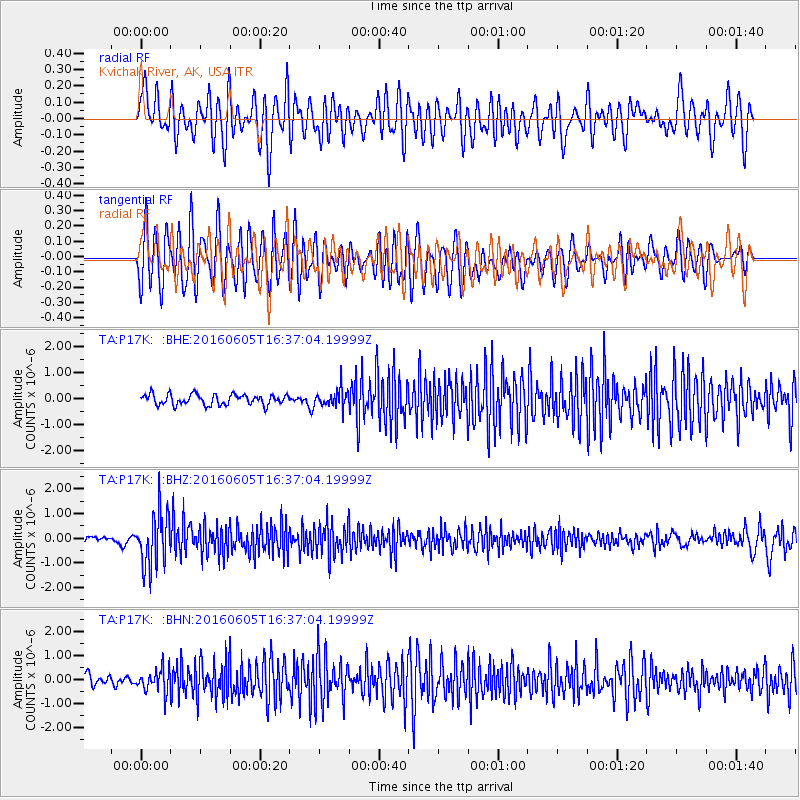
P17K Kvichak River, AK, USA - Earthquake Result Viewer
*The percent match for this event was below the threshold and hence no stack was calculated.
| Earthquake location: |
Banda Sea |
| Earthquake latitude/longitude: |
-4.6/125.6 |
| Earthquake time(UTC): |
2016/06/05 (157) 16:25:33 GMT |
| Earthquake Depth: |
429 km |
| Earthquake Magnitude: |
6.3 MWB |
| Earthquake Catalog/Contributor: |
NEIC PDE/NEIC COMCAT |
|
| Network: |
TA USArray Transportable Network (new EarthScope stations) |
| Station: |
P17K Kvichak River, AK, USA |
| Lat/Lon: |
59.20 N/156.44 W |
| Elevation: |
91 m |
|
| Distance: |
87.8 deg |
| Az: |
30.244 deg |
| Baz: |
257.313 deg |
| Ray Param: |
$rayparam |
*The percent match for this event was below the threshold and hence was not used in the summary stack. |
|
| Radial Match: |
63.149597 % |
| Radial Bump: |
400 |
| Transverse Match: |
59.855915 % |
| Transverse Bump: |
400 |
| SOD ConfigId: |
7422571 |
| Insert Time: |
2019-04-22 18:03:17.663 +0000 |
| GWidth: |
2.5 |
| Max Bumps: |
400 |
| Tol: |
0.001 |
|
Signal To Noise
| Channel | StoN | STA | LTA |
| TA:P17K: :BHZ:20160605T16:37:04.19999Z | 10.869565 | 1.116461E-6 | 1.0271441E-7 |
| TA:P17K: :BHN:20160605T16:37:04.19999Z | 2.1208408 | 4.7860965E-7 | 2.2566978E-7 |
| TA:P17K: :BHE:20160605T16:37:04.19999Z | 1.6622834 | 3.3263032E-7 | 2.0010447E-7 |
| Arrivals |
| Ps | |
| PpPs | |
| PsPs/PpSs | |


