You are here: Home > Network List > IU - Global Seismograph Network (GSN - IRIS/USGS) Stations List
> Station POHA Pohakuloa, Hawaii, USA > Earthquake Result Viewer
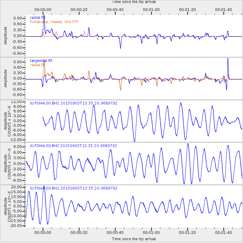
POHA Pohakuloa, Hawaii, USA - Earthquake Result Viewer
*The percent match for this event was below the threshold and hence no stack was calculated.
| Earthquake location: |
Northern Molucca Sea |
| Earthquake latitude/longitude: |
2.1/126.7 |
| Earthquake time(UTC): |
2015/09/03 (246) 13:23:59 GMT |
| Earthquake Depth: |
44 km |
| Earthquake Magnitude: |
5.6 MB |
| Earthquake Catalog/Contributor: |
NEIC PDE/NEIC COMCAT |
|
| Network: |
IU Global Seismograph Network (GSN - IRIS/USGS) |
| Station: |
POHA Pohakuloa, Hawaii, USA |
| Lat/Lon: |
19.76 N/155.53 W |
| Elevation: |
1990 m |
|
| Distance: |
77.8 deg |
| Az: |
70.353 deg |
| Baz: |
267.816 deg |
| Ray Param: |
$rayparam |
*The percent match for this event was below the threshold and hence was not used in the summary stack. |
|
| Radial Match: |
61.620674 % |
| Radial Bump: |
400 |
| Transverse Match: |
40.782635 % |
| Transverse Bump: |
400 |
| SOD ConfigId: |
1156111 |
| Insert Time: |
2015-09-17 13:56:15.419 +0000 |
| GWidth: |
2.5 |
| Max Bumps: |
400 |
| Tol: |
0.001 |
|
Signal To Noise
| Channel | StoN | STA | LTA |
| IU:POHA:00:BHZ:20150903T13:35:20.968979Z | 0.7807024 | 2.9832902E-6 | 3.8212897E-6 |
| IU:POHA:00:BH1:20150903T13:35:20.968979Z | 1.7126182 | 1.306776E-5 | 7.630282E-6 |
| IU:POHA:00:BH2:20150903T13:35:20.968979Z | 1.2731992 | 4.9840305E-6 | 3.9145725E-6 |
| Arrivals |
| Ps | |
| PpPs | |
| PsPs/PpSs | |


