You are here: Home > Network List > UW - Pacific Northwest Regional Seismic Network Stations List
> Station HEBO Mt. Hebo, OR CREST BB SMO > Earthquake Result Viewer
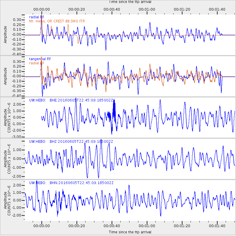
HEBO Mt. Hebo, OR CREST BB SMO - Earthquake Result Viewer
*The percent match for this event was below the threshold and hence no stack was calculated.
| Earthquake location: |
Tonga Islands Region |
| Earthquake latitude/longitude: |
-17.6/-172.6 |
| Earthquake time(UTC): |
2016/06/05 (157) 22:33:49 GMT |
| Earthquake Depth: |
10 km |
| Earthquake Magnitude: |
5.6 MWW, 5.6 MWC, 5.6 MWB |
| Earthquake Catalog/Contributor: |
NEIC PDE/NEIC COMCAT |
|
| Network: |
UW Pacific Northwest Regional Seismic Network |
| Station: |
HEBO Mt. Hebo, OR CREST BB SMO |
| Lat/Lon: |
45.21 N/123.76 W |
| Elevation: |
875 m |
|
| Distance: |
76.7 deg |
| Az: |
33.172 deg |
| Baz: |
227.57 deg |
| Ray Param: |
$rayparam |
*The percent match for this event was below the threshold and hence was not used in the summary stack. |
|
| Radial Match: |
50.512417 % |
| Radial Bump: |
400 |
| Transverse Match: |
54.88688 % |
| Transverse Bump: |
400 |
| SOD ConfigId: |
7422571 |
| Insert Time: |
2019-04-22 18:10:52.611 +0000 |
| GWidth: |
2.5 |
| Max Bumps: |
400 |
| Tol: |
0.001 |
|
Signal To Noise
| Channel | StoN | STA | LTA |
| UW:HEBO: :BHZ:20160605T22:45:09.185002Z | 0.63365674 | 4.535502E-7 | 7.1576636E-7 |
| UW:HEBO: :BHN:20160605T22:45:09.185002Z | 1.1453955 | 9.323788E-7 | 8.140234E-7 |
| UW:HEBO: :BHE:20160605T22:45:09.185002Z | 0.5656088 | 6.2226036E-7 | 1.1001604E-6 |
| Arrivals |
| Ps | |
| PpPs | |
| PsPs/PpSs | |


