You are here: Home > Network List > TA - USArray Transportable Network (new EarthScope stations) Stations List
> Station J26L Joseph Creek, AK, USA > Earthquake Result Viewer
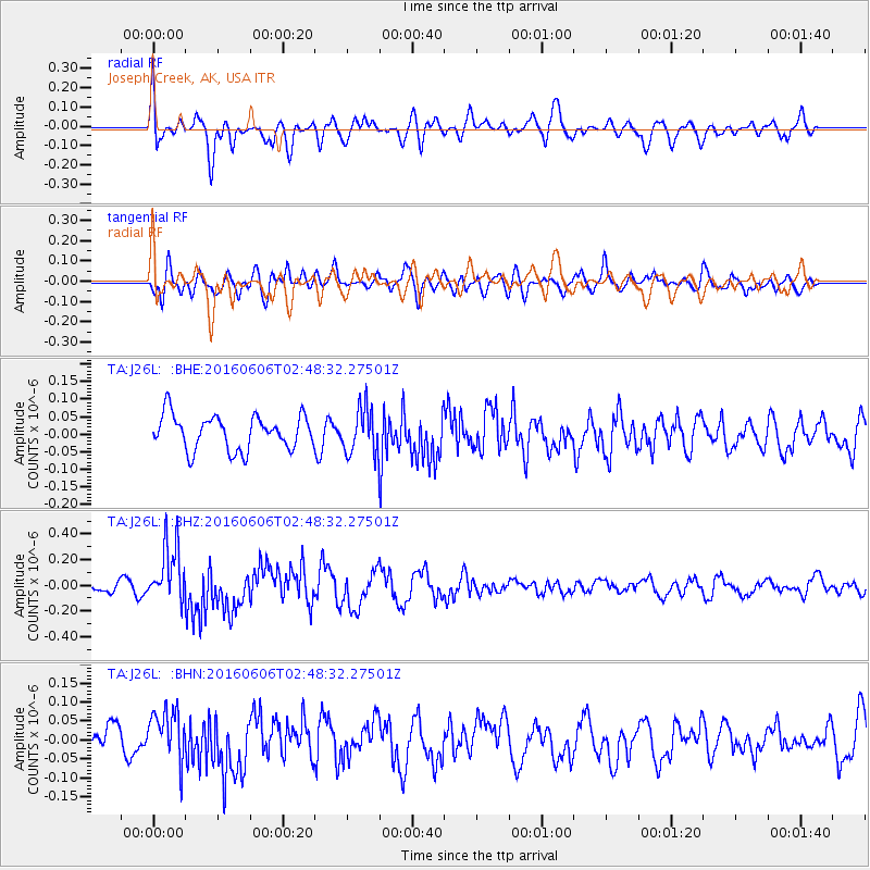
J26L Joseph Creek, AK, USA - Earthquake Result Viewer
*The percent match for this event was below the threshold and hence no stack was calculated.
| Earthquake location: |
Kermadec Islands, New Zealand |
| Earthquake latitude/longitude: |
-30.0/-177.8 |
| Earthquake time(UTC): |
2016/06/06 (158) 02:35:32 GMT |
| Earthquake Depth: |
44 km |
| Earthquake Magnitude: |
6.1 MWW, 6.0 MWC, 6.1 MWC |
| Earthquake Catalog/Contributor: |
NEIC PDE/NEIC COMCAT |
|
| Network: |
TA USArray Transportable Network (new EarthScope stations) |
| Station: |
J26L Joseph Creek, AK, USA |
| Lat/Lon: |
64.50 N/143.56 W |
| Elevation: |
1144 m |
|
| Distance: |
98.0 deg |
| Az: |
14.248 deg |
| Baz: |
209.547 deg |
| Ray Param: |
$rayparam |
*The percent match for this event was below the threshold and hence was not used in the summary stack. |
|
| Radial Match: |
57.9522 % |
| Radial Bump: |
400 |
| Transverse Match: |
53.969044 % |
| Transverse Bump: |
400 |
| SOD ConfigId: |
7422571 |
| Insert Time: |
2019-04-22 18:19:09.153 +0000 |
| GWidth: |
2.5 |
| Max Bumps: |
400 |
| Tol: |
0.001 |
|
Signal To Noise
| Channel | StoN | STA | LTA |
| TA:J26L: :BHZ:20160606T02:48:32.27501Z | 3.53844 | 2.3145222E-7 | 6.541081E-8 |
| TA:J26L: :BHN:20160606T02:48:32.27501Z | 1.2189326 | 6.9372426E-8 | 5.6912437E-8 |
| TA:J26L: :BHE:20160606T02:48:32.27501Z | 1.3402444 | 6.493305E-8 | 4.8448662E-8 |
| Arrivals |
| Ps | |
| PpPs | |
| PsPs/PpSs | |


