You are here: Home > Network List > US - United States National Seismic Network Stations List
> Station DUG Dugway, Tooele County, Utah, USA > Earthquake Result Viewer
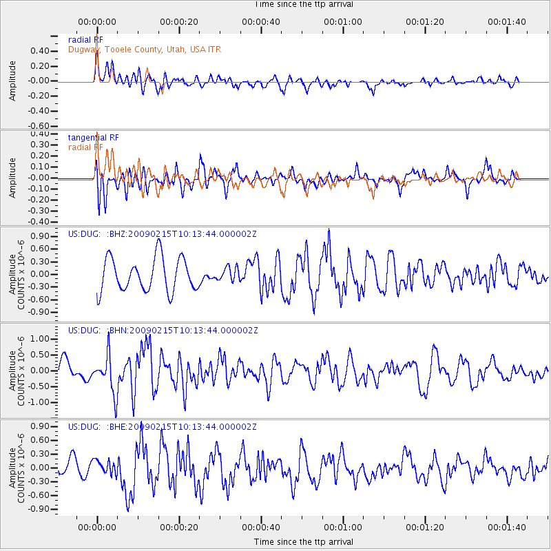
DUG Dugway, Tooele County, Utah, USA - Earthquake Result Viewer
*The percent match for this event was below the threshold and hence no stack was calculated.
| Earthquake location: |
Near Coast Of Northern Peru |
| Earthquake latitude/longitude: |
-5.9/-80.9 |
| Earthquake time(UTC): |
2009/02/15 (046) 10:04:49 GMT |
| Earthquake Depth: |
21 km |
| Earthquake Magnitude: |
5.8 MB, 5.7 MS, 6.1 MW, 6.1 MW |
| Earthquake Catalog/Contributor: |
WHDF/NEIC |
|
| Network: |
US United States National Seismic Network |
| Station: |
DUG Dugway, Tooele County, Utah, USA |
| Lat/Lon: |
40.19 N/112.81 W |
| Elevation: |
1477 m |
|
| Distance: |
54.4 deg |
| Az: |
330.137 deg |
| Baz: |
139.706 deg |
| Ray Param: |
$rayparam |
*The percent match for this event was below the threshold and hence was not used in the summary stack. |
|
| Radial Match: |
43.351997 % |
| Radial Bump: |
396 |
| Transverse Match: |
57.763893 % |
| Transverse Bump: |
400 |
| SOD ConfigId: |
2658 |
| Insert Time: |
2010-03-05 04:17:06.496 +0000 |
| GWidth: |
2.5 |
| Max Bumps: |
400 |
| Tol: |
0.001 |
|
Signal To Noise
| Channel | StoN | STA | LTA |
| US:DUG: :BHN:20090215T10:13:44.000002Z | 1.8199253 | 6.22118E-7 | 3.418371E-7 |
| US:DUG: :BHE:20090215T10:13:44.000002Z | 0.52766484 | 1.484111E-7 | 2.8126016E-7 |
| US:DUG: :BHZ:20090215T10:13:44.000002Z | 0.41075358 | 1.619917E-7 | 3.9437683E-7 |
| Arrivals |
| Ps | |
| PpPs | |
| PsPs/PpSs | |


