You are here: Home > Network List > US - United States National Seismic Network Stations List
> Station DUG Dugway, Tooele County, Utah, USA > Earthquake Result Viewer
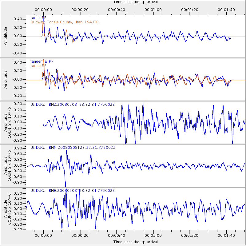
DUG Dugway, Tooele County, Utah, USA - Earthquake Result Viewer
*The percent match for this event was below the threshold and hence no stack was calculated.
| Earthquake location: |
Near East Coast Of Honshu, Japan |
| Earthquake latitude/longitude: |
36.1/141.7 |
| Earthquake time(UTC): |
2008/05/08 (129) 23:21:06 GMT |
| Earthquake Depth: |
17 km |
| Earthquake Magnitude: |
5.6 MB, 5.2 MS, 5.6 MW, 5.5 MW |
| Earthquake Catalog/Contributor: |
WHDF/NEIC |
|
| Network: |
US United States National Seismic Network |
| Station: |
DUG Dugway, Tooele County, Utah, USA |
| Lat/Lon: |
40.19 N/112.81 W |
| Elevation: |
1477 m |
|
| Distance: |
77.8 deg |
| Az: |
49.041 deg |
| Baz: |
307.026 deg |
| Ray Param: |
$rayparam |
*The percent match for this event was below the threshold and hence was not used in the summary stack. |
|
| Radial Match: |
74.81289 % |
| Radial Bump: |
400 |
| Transverse Match: |
76.523636 % |
| Transverse Bump: |
400 |
| SOD ConfigId: |
2504 |
| Insert Time: |
2010-03-05 04:17:18.160 +0000 |
| GWidth: |
2.5 |
| Max Bumps: |
400 |
| Tol: |
0.001 |
|
Signal To Noise
| Channel | StoN | STA | LTA |
| US:DUG: :BHN:20080508T23:32:31.775002Z | 3.5375984 | 1.5289112E-7 | 4.32189E-8 |
| US:DUG: :BHE:20080508T23:32:31.775002Z | 0.8736101 | 7.487855E-8 | 8.571163E-8 |
| US:DUG: :BHZ:20080508T23:32:31.775002Z | 0.6591428 | 4.4875172E-8 | 6.808111E-8 |
| Arrivals |
| Ps | |
| PpPs | |
| PsPs/PpSs | |


