You are here: Home > Network List > US - United States National Seismic Network Stations List
> Station DUG Dugway, Tooele County, Utah, USA > Earthquake Result Viewer
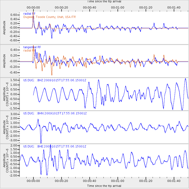
DUG Dugway, Tooele County, Utah, USA - Earthquake Result Viewer
*The percent match for this event was below the threshold and hence no stack was calculated.
| Earthquake location: |
Galapagos Triple Junction Region |
| Earthquake latitude/longitude: |
3.3/-103.8 |
| Earthquake time(UTC): |
2009/10/15 (288) 17:48:21 GMT |
| Earthquake Depth: |
10 km |
| Earthquake Magnitude: |
5.9 MB, 5.7 MS, 6.0 MW, 6.0 MW |
| Earthquake Catalog/Contributor: |
WHDF/NEIC |
|
| Network: |
US United States National Seismic Network |
| Station: |
DUG Dugway, Tooele County, Utah, USA |
| Lat/Lon: |
40.19 N/112.81 W |
| Elevation: |
1477 m |
|
| Distance: |
37.6 deg |
| Az: |
348.698 deg |
| Baz: |
165.2 deg |
| Ray Param: |
$rayparam |
*The percent match for this event was below the threshold and hence was not used in the summary stack. |
|
| Radial Match: |
70.7298 % |
| Radial Bump: |
400 |
| Transverse Match: |
38.06733 % |
| Transverse Bump: |
384 |
| SOD ConfigId: |
2622 |
| Insert Time: |
2010-03-05 04:17:57.767 +0000 |
| GWidth: |
2.5 |
| Max Bumps: |
400 |
| Tol: |
0.001 |
|
Signal To Noise
| Channel | StoN | STA | LTA |
| US:DUG: :BHN:20091015T17:55:06.15001Z | 2.2088938 | 7.6396606E-7 | 3.4585912E-7 |
| US:DUG: :BHE:20091015T17:55:06.15001Z | 0.36421868 | 2.1232472E-7 | 5.8295944E-7 |
| US:DUG: :BHZ:20091015T17:55:06.15001Z | 0.89429474 | 4.5960826E-7 | 5.139338E-7 |
| Arrivals |
| Ps | |
| PpPs | |
| PsPs/PpSs | |


