You are here: Home > Network List > US - United States National Seismic Network Stations List
> Station CBKS Cedar Bluff, Kansas, USA > Earthquake Result Viewer
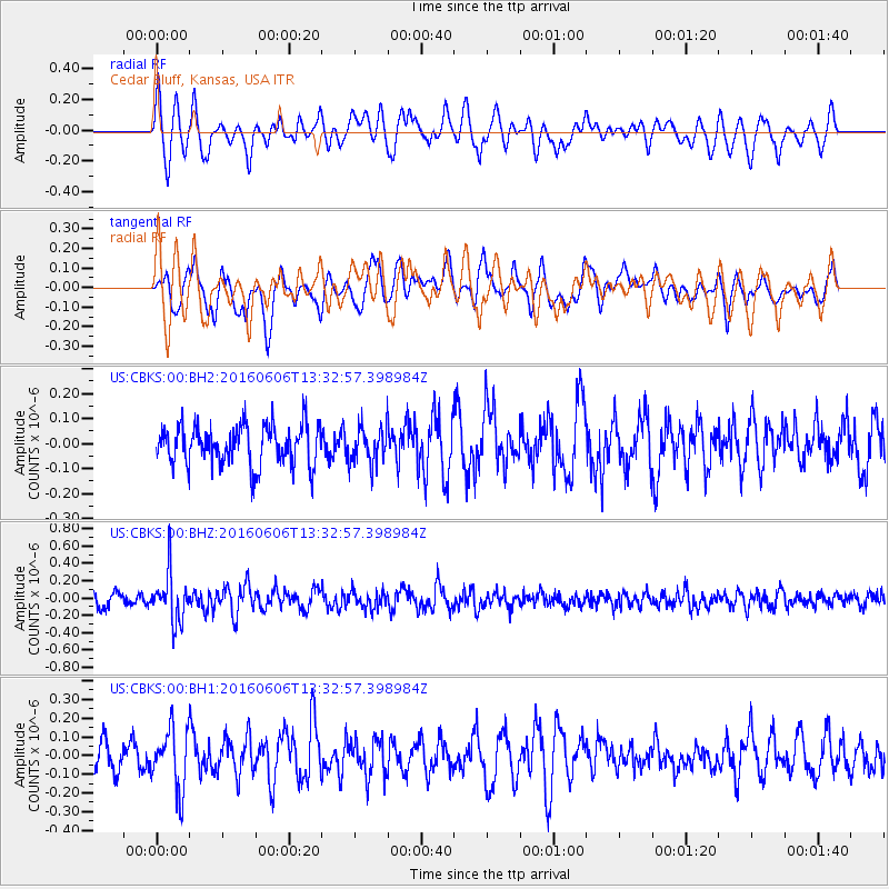
CBKS Cedar Bluff, Kansas, USA - Earthquake Result Viewer
*The percent match for this event was below the threshold and hence no stack was calculated.
| Earthquake location: |
Near Coast Of Central Chile |
| Earthquake latitude/longitude: |
-30.1/-71.5 |
| Earthquake time(UTC): |
2016/06/06 (158) 13:21:59 GMT |
| Earthquake Depth: |
30 km |
| Earthquake Magnitude: |
5.4 Mww |
| Earthquake Catalog/Contributor: |
NEIC PDE/us |
|
| Network: |
US United States National Seismic Network |
| Station: |
CBKS Cedar Bluff, Kansas, USA |
| Lat/Lon: |
38.81 N/99.74 W |
| Elevation: |
677 m |
|
| Distance: |
73.4 deg |
| Az: |
337.332 deg |
| Baz: |
154.683 deg |
| Ray Param: |
$rayparam |
*The percent match for this event was below the threshold and hence was not used in the summary stack. |
|
| Radial Match: |
58.97009 % |
| Radial Bump: |
400 |
| Transverse Match: |
59.84444 % |
| Transverse Bump: |
400 |
| SOD ConfigId: |
7422571 |
| Insert Time: |
2019-04-22 18:38:34.682 +0000 |
| GWidth: |
2.5 |
| Max Bumps: |
400 |
| Tol: |
0.001 |
|
Signal To Noise
| Channel | StoN | STA | LTA |
| US:CBKS:00:BHZ:20160606T13:32:57.398984Z | 3.335785 | 2.764857E-7 | 8.288475E-8 |
| US:CBKS:00:BH1:20160606T13:32:57.398984Z | 1.6610678 | 1.6428572E-7 | 9.890368E-8 |
| US:CBKS:00:BH2:20160606T13:32:57.398984Z | 0.91574425 | 7.3718255E-8 | 8.050092E-8 |
| Arrivals |
| Ps | |
| PpPs | |
| PsPs/PpSs | |


