You are here: Home > Network List > GS - US Geological Survey Networks Stations List
> Station DEC05 Decatur Surface Seismic Site, Decatur, IL, USA > Earthquake Result Viewer
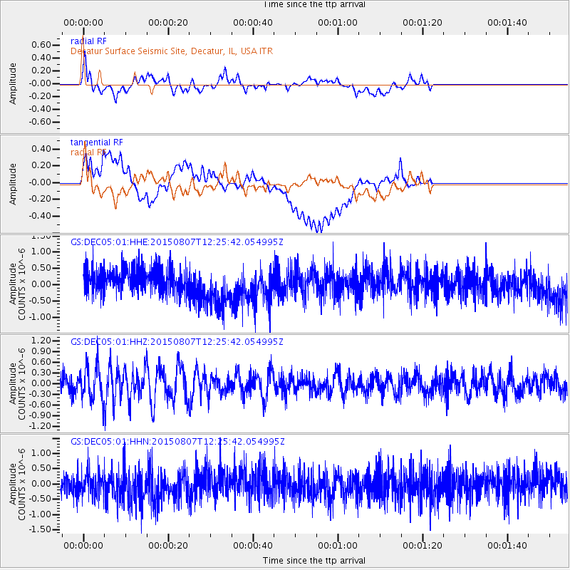
DEC05 Decatur Surface Seismic Site, Decatur, IL, USA - Earthquake Result Viewer
*The percent match for this event was below the threshold and hence no stack was calculated.
| Earthquake location: |
Off Coast Of Ecuador |
| Earthquake latitude/longitude: |
1.1/-85.2 |
| Earthquake time(UTC): |
2015/08/07 (219) 12:18:48 GMT |
| Earthquake Depth: |
10 km |
| Earthquake Magnitude: |
5.6 MWW, 5.6 MWC, 5.6 MWB |
| Earthquake Catalog/Contributor: |
NEIC PDE/NEIC COMCAT |
|
| Network: |
GS US Geological Survey Networks |
| Station: |
DEC05 Decatur Surface Seismic Site, Decatur, IL, USA |
| Lat/Lon: |
39.87 N/88.87 W |
| Elevation: |
216 m |
|
| Distance: |
38.7 deg |
| Az: |
355.457 deg |
| Baz: |
174.093 deg |
| Ray Param: |
$rayparam |
*The percent match for this event was below the threshold and hence was not used in the summary stack. |
|
| Radial Match: |
57.522182 % |
| Radial Bump: |
400 |
| Transverse Match: |
34.232502 % |
| Transverse Bump: |
400 |
| SOD ConfigId: |
1156111 |
| Insert Time: |
2015-09-17 14:22:55.560 +0000 |
| GWidth: |
2.5 |
| Max Bumps: |
400 |
| Tol: |
0.001 |
|
Signal To Noise
| Channel | StoN | STA | LTA |
| GS:DEC05:01:HHZ:20150807T12:25:42.054995Z | 2.142699 | 4.7614947E-7 | 2.2221948E-7 |
| GS:DEC05:01:HHN:20150807T12:25:42.054995Z | 0.87179023 | 4.1184222E-7 | 4.724098E-7 |
| GS:DEC05:01:HHE:20150807T12:25:42.054995Z | 1.9554864 | 7.1714715E-7 | 3.6673592E-7 |
| Arrivals |
| Ps | |
| PpPs | |
| PsPs/PpSs | |


