You are here: Home > Network List > AK - Alaska Regional Network Stations List
> Station MDM Murphy Dome > Earthquake Result Viewer
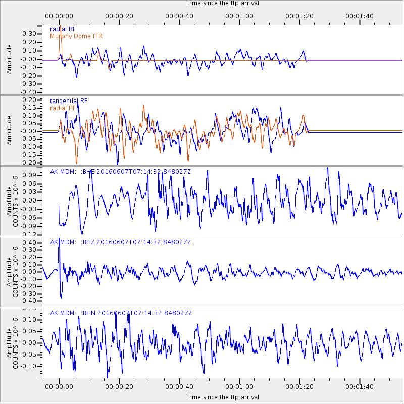
MDM Murphy Dome - Earthquake Result Viewer
*The percent match for this event was below the threshold and hence no stack was calculated.
| Earthquake location: |
South Of Fiji Islands |
| Earthquake latitude/longitude: |
-23.7/-179.9 |
| Earthquake time(UTC): |
2016/06/07 (159) 07:02:52 GMT |
| Earthquake Depth: |
523 km |
| Earthquake Magnitude: |
5.5 MB |
| Earthquake Catalog/Contributor: |
NEIC PDE/NEIC COMCAT |
|
| Network: |
AK Alaska Regional Network |
| Station: |
MDM Murphy Dome |
| Lat/Lon: |
64.96 N/148.23 W |
| Elevation: |
634 m |
|
| Distance: |
91.6 deg |
| Az: |
12.899 deg |
| Baz: |
208.749 deg |
| Ray Param: |
$rayparam |
*The percent match for this event was below the threshold and hence was not used in the summary stack. |
|
| Radial Match: |
54.65962 % |
| Radial Bump: |
400 |
| Transverse Match: |
54.680443 % |
| Transverse Bump: |
400 |
| SOD ConfigId: |
7422571 |
| Insert Time: |
2019-04-22 18:44:59.165 +0000 |
| GWidth: |
2.5 |
| Max Bumps: |
400 |
| Tol: |
0.001 |
|
Signal To Noise
| Channel | StoN | STA | LTA |
| AK:MDM: :BHZ:20160607T07:14:32.848027Z | 2.2998743 | 1.6369187E-7 | 7.117426E-8 |
| AK:MDM: :BHN:20160607T07:14:32.848027Z | 1.8394206 | 5.3632185E-8 | 2.9157109E-8 |
| AK:MDM: :BHE:20160607T07:14:32.848027Z | 1.2059433 | 5.874834E-8 | 4.8715673E-8 |
| Arrivals |
| Ps | |
| PpPs | |
| PsPs/PpSs | |


