You are here: Home > Network List > CI - Caltech Regional Seismic Network Stations List
> Station MPP McPhearson Peak > Earthquake Result Viewer
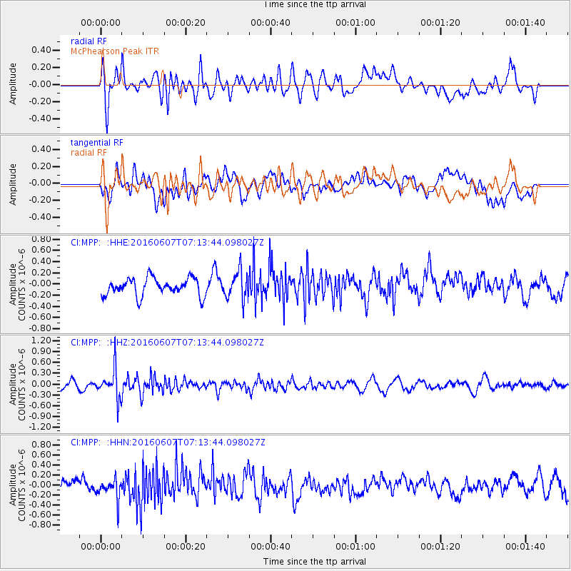
MPP McPhearson Peak - Earthquake Result Viewer
*The percent match for this event was below the threshold and hence no stack was calculated.
| Earthquake location: |
South Of Fiji Islands |
| Earthquake latitude/longitude: |
-23.7/-179.9 |
| Earthquake time(UTC): |
2016/06/07 (159) 07:02:52 GMT |
| Earthquake Depth: |
523 km |
| Earthquake Magnitude: |
5.5 MB |
| Earthquake Catalog/Contributor: |
NEIC PDE/NEIC COMCAT |
|
| Network: |
CI Caltech Regional Seismic Network |
| Station: |
MPP McPhearson Peak |
| Lat/Lon: |
34.89 N/119.81 W |
| Elevation: |
1739 m |
|
| Distance: |
81.4 deg |
| Az: |
46.077 deg |
| Baz: |
233.459 deg |
| Ray Param: |
$rayparam |
*The percent match for this event was below the threshold and hence was not used in the summary stack. |
|
| Radial Match: |
66.56079 % |
| Radial Bump: |
400 |
| Transverse Match: |
47.295216 % |
| Transverse Bump: |
400 |
| SOD ConfigId: |
7422571 |
| Insert Time: |
2019-04-22 18:47:21.037 +0000 |
| GWidth: |
2.5 |
| Max Bumps: |
400 |
| Tol: |
0.001 |
|
Signal To Noise
| Channel | StoN | STA | LTA |
| CI:MPP: :HHZ:20160607T07:13:44.098027Z | 2.9519165 | 4.1757966E-7 | 1.4146053E-7 |
| CI:MPP: :HHN:20160607T07:13:44.098027Z | 1.2508361 | 2.0229531E-7 | 1.6172808E-7 |
| CI:MPP: :HHE:20160607T07:13:44.098027Z | 1.6068846 | 2.4879938E-7 | 1.5483339E-7 |
| Arrivals |
| Ps | |
| PpPs | |
| PsPs/PpSs | |


