You are here: Home > Network List > CI - Caltech Regional Seismic Network Stations List
> Station MPM Manuel Prospect Mine, California, USA > Earthquake Result Viewer
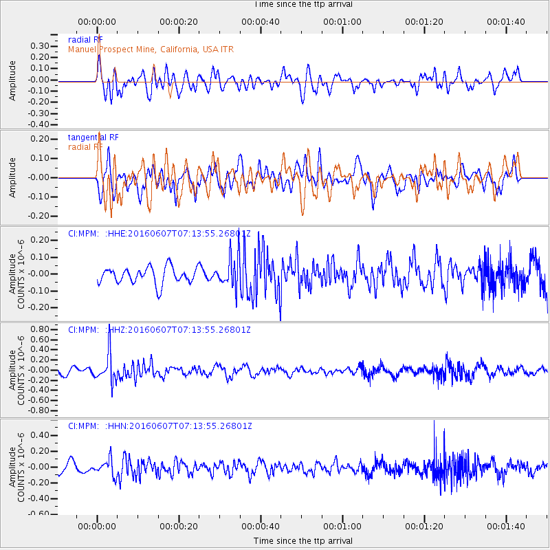
MPM Manuel Prospect Mine, California, USA - Earthquake Result Viewer
*The percent match for this event was below the threshold and hence no stack was calculated.
| Earthquake location: |
South Of Fiji Islands |
| Earthquake latitude/longitude: |
-23.7/-179.9 |
| Earthquake time(UTC): |
2016/06/07 (159) 07:02:52 GMT |
| Earthquake Depth: |
523 km |
| Earthquake Magnitude: |
5.5 MB |
| Earthquake Catalog/Contributor: |
NEIC PDE/NEIC COMCAT |
|
| Network: |
CI Caltech Regional Seismic Network |
| Station: |
MPM Manuel Prospect Mine, California, USA |
| Lat/Lon: |
36.06 N/117.49 W |
| Elevation: |
185 m |
|
| Distance: |
83.6 deg |
| Az: |
46.244 deg |
| Baz: |
234.824 deg |
| Ray Param: |
$rayparam |
*The percent match for this event was below the threshold and hence was not used in the summary stack. |
|
| Radial Match: |
61.11646 % |
| Radial Bump: |
400 |
| Transverse Match: |
51.458443 % |
| Transverse Bump: |
400 |
| SOD ConfigId: |
7422571 |
| Insert Time: |
2019-04-22 18:47:21.217 +0000 |
| GWidth: |
2.5 |
| Max Bumps: |
400 |
| Tol: |
0.001 |
|
Signal To Noise
| Channel | StoN | STA | LTA |
| CI:MPM: :HHZ:20160607T07:13:55.26801Z | 3.5843244 | 2.9129762E-7 | 8.126988E-8 |
| CI:MPM: :HHN:20160607T07:13:55.26801Z | 1.9161432 | 1.053571E-7 | 5.498394E-8 |
| CI:MPM: :HHE:20160607T07:13:55.26801Z | 1.5402689 | 7.3436155E-8 | 4.7677492E-8 |
| Arrivals |
| Ps | |
| PpPs | |
| PsPs/PpSs | |


