You are here: Home > Network List > TA - USArray Transportable Network (new EarthScope stations) Stations List
> Station 121A Cookes Peak, Deming, NM, USA > Earthquake Result Viewer
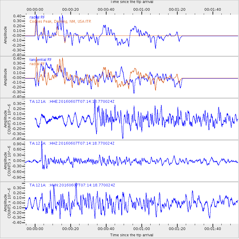
121A Cookes Peak, Deming, NM, USA - Earthquake Result Viewer
*The percent match for this event was below the threshold and hence no stack was calculated.
| Earthquake location: |
South Of Fiji Islands |
| Earthquake latitude/longitude: |
-23.7/-179.9 |
| Earthquake time(UTC): |
2016/06/07 (159) 07:02:52 GMT |
| Earthquake Depth: |
523 km |
| Earthquake Magnitude: |
5.5 MB |
| Earthquake Catalog/Contributor: |
NEIC PDE/NEIC COMCAT |
|
| Network: |
TA USArray Transportable Network (new EarthScope stations) |
| Station: |
121A Cookes Peak, Deming, NM, USA |
| Lat/Lon: |
32.53 N/107.79 W |
| Elevation: |
1652 m |
|
| Distance: |
88.6 deg |
| Az: |
53.507 deg |
| Baz: |
240.773 deg |
| Ray Param: |
$rayparam |
*The percent match for this event was below the threshold and hence was not used in the summary stack. |
|
| Radial Match: |
62.284885 % |
| Radial Bump: |
400 |
| Transverse Match: |
56.65713 % |
| Transverse Bump: |
400 |
| SOD ConfigId: |
7422571 |
| Insert Time: |
2019-04-22 18:49:47.107 +0000 |
| GWidth: |
2.5 |
| Max Bumps: |
400 |
| Tol: |
0.001 |
|
Signal To Noise
| Channel | StoN | STA | LTA |
| TA:121A: :HHZ:20160607T07:14:18.770024Z | 3.5433025 | 2.8106882E-7 | 7.9323975E-8 |
| TA:121A: :HHN:20160607T07:14:18.770024Z | 1.626832 | 9.965354E-8 | 6.1256195E-8 |
| TA:121A: :HHE:20160607T07:14:18.770024Z | 1.6815928 | 1.14761484E-7 | 6.8245704E-8 |
| Arrivals |
| Ps | |
| PpPs | |
| PsPs/PpSs | |


