You are here: Home > Network List > UW - Pacific Northwest Regional Seismic Network Stations List
> Station LEBA Lebam, WA, USA > Earthquake Result Viewer
LEBA Lebam, WA, USA - Earthquake Result Viewer
*The percent match for this event was below the threshold and hence no stack was calculated.
| Earthquake location: |
South Of Fiji Islands |
| Earthquake latitude/longitude: |
-23.7/-179.9 |
| Earthquake time(UTC): |
2016/06/07 (159) 07:02:52 GMT |
| Earthquake Depth: |
523 km |
| Earthquake Magnitude: |
5.5 MB |
| Earthquake Catalog/Contributor: |
NEIC PDE/NEIC COMCAT |
|
| Network: |
UW Pacific Northwest Regional Seismic Network |
| Station: |
LEBA Lebam, WA, USA |
| Lat/Lon: |
46.55 N/123.56 W |
| Elevation: |
73 m |
|
| Distance: |
86.4 deg |
| Az: |
35.118 deg |
| Baz: |
229.842 deg |
| Ray Param: |
$rayparam |
*The percent match for this event was below the threshold and hence was not used in the summary stack. |
|
| Radial Match: |
47.35754 % |
| Radial Bump: |
400 |
| Transverse Match: |
58.81087 % |
| Transverse Bump: |
400 |
| SOD ConfigId: |
7422571 |
| Insert Time: |
2019-04-22 18:51:07.439 +0000 |
| GWidth: |
2.5 |
| Max Bumps: |
400 |
| Tol: |
0.001 |
|
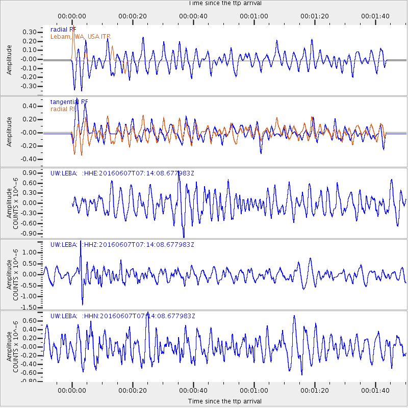
Signal To Noise
| Channel | StoN | STA | LTA |
| UW:LEBA: :HHZ:20160607T07:14:08.677983Z | 2.3855152 | 5.3868126E-7 | 2.258134E-7 |
| UW:LEBA: :HHN:20160607T07:14:08.677983Z | 1.1807053 | 2.957145E-7 | 2.504558E-7 |
| UW:LEBA: :HHE:20160607T07:14:08.677983Z | 0.9180277 | 2.3932495E-7 | 2.606947E-7 |
| Arrivals |
| Ps | |
| PpPs | |
| PsPs/PpSs | |


