You are here: Home > Network List > AV - Alaska Volcano Observatory Stations List
> Station MAPS Pakushin Southeast, Makushin Volcano, Alaska > Earthquake Result Viewer
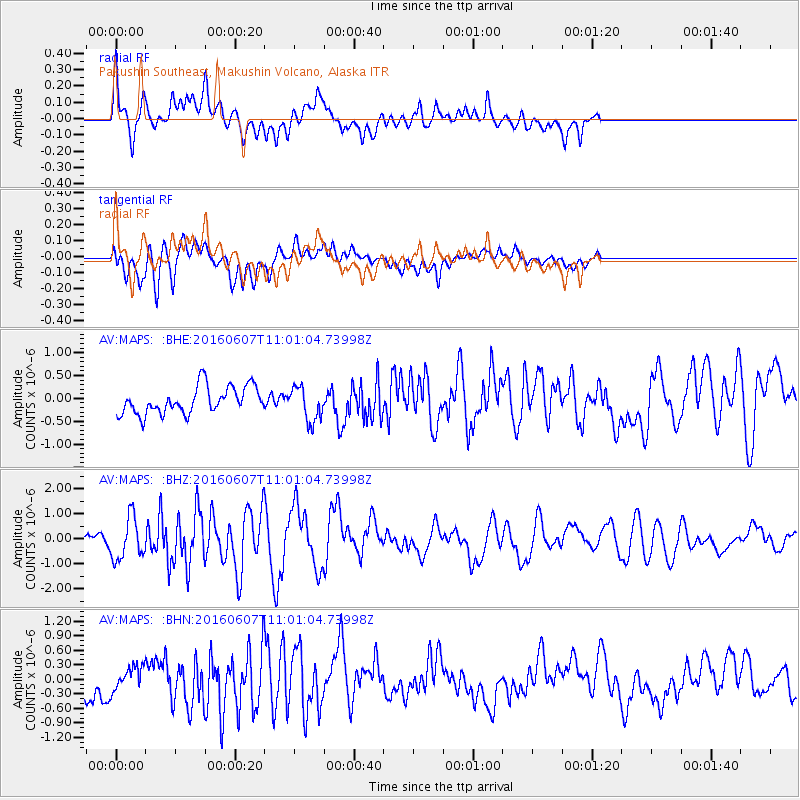
MAPS Pakushin Southeast, Makushin Volcano, Alaska - Earthquake Result Viewer
*The percent match for this event was below the threshold and hence no stack was calculated.
| Earthquake location: |
Off Coast Of Jalisco, Mexico |
| Earthquake latitude/longitude: |
18.4/-105.2 |
| Earthquake time(UTC): |
2016/06/07 (159) 10:51:38 GMT |
| Earthquake Depth: |
10 km |
| Earthquake Magnitude: |
6.2 MWP |
| Earthquake Catalog/Contributor: |
NEIC PDE/NEIC COMCAT |
|
| Network: |
AV Alaska Volcano Observatory |
| Station: |
MAPS Pakushin Southeast, Makushin Volcano, Alaska |
| Lat/Lon: |
53.81 N/166.94 W |
| Elevation: |
333 m |
|
| Distance: |
58.7 deg |
| Az: |
322.314 deg |
| Baz: |
101.857 deg |
| Ray Param: |
$rayparam |
*The percent match for this event was below the threshold and hence was not used in the summary stack. |
|
| Radial Match: |
76.951546 % |
| Radial Bump: |
400 |
| Transverse Match: |
65.02252 % |
| Transverse Bump: |
400 |
| SOD ConfigId: |
7422571 |
| Insert Time: |
2019-04-22 18:55:22.089 +0000 |
| GWidth: |
2.5 |
| Max Bumps: |
400 |
| Tol: |
0.001 |
|
Signal To Noise
| Channel | StoN | STA | LTA |
| AV:MAPS: :BHZ:20160607T11:01:04.73998Z | 4.1794367 | 8.4939006E-7 | 2.0323075E-7 |
| AV:MAPS: :BHN:20160607T11:01:04.73998Z | 0.83157206 | 2.3486984E-7 | 2.8244077E-7 |
| AV:MAPS: :BHE:20160607T11:01:04.73998Z | 1.2769274 | 3.730925E-7 | 2.921799E-7 |
| Arrivals |
| Ps | |
| PpPs | |
| PsPs/PpSs | |


