You are here: Home > Network List > UW - Pacific Northwest Regional Seismic Network Stations List
> Station PASS Maple Falls, WA, USA > Earthquake Result Viewer
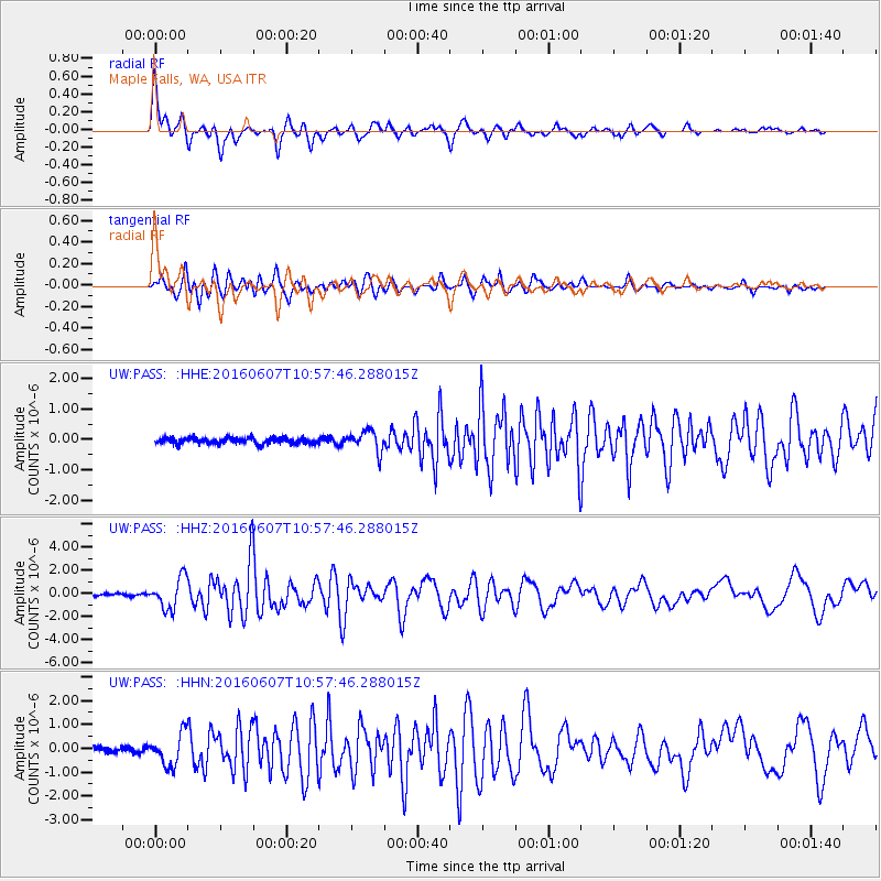
PASS Maple Falls, WA, USA - Earthquake Result Viewer
*The percent match for this event was below the threshold and hence no stack was calculated.
| Earthquake location: |
Off Coast Of Jalisco, Mexico |
| Earthquake latitude/longitude: |
18.4/-105.2 |
| Earthquake time(UTC): |
2016/06/07 (159) 10:51:38 GMT |
| Earthquake Depth: |
10 km |
| Earthquake Magnitude: |
6.2 MWP |
| Earthquake Catalog/Contributor: |
NEIC PDE/NEIC COMCAT |
|
| Network: |
UW Pacific Northwest Regional Seismic Network |
| Station: |
PASS Maple Falls, WA, USA |
| Lat/Lon: |
49.00 N/122.09 W |
| Elevation: |
174 m |
|
| Distance: |
33.4 deg |
| Az: |
339.669 deg |
| Baz: |
149.941 deg |
| Ray Param: |
$rayparam |
*The percent match for this event was below the threshold and hence was not used in the summary stack. |
|
| Radial Match: |
79.29626 % |
| Radial Bump: |
400 |
| Transverse Match: |
76.87458 % |
| Transverse Bump: |
400 |
| SOD ConfigId: |
7422571 |
| Insert Time: |
2019-04-22 19:02:26.418 +0000 |
| GWidth: |
2.5 |
| Max Bumps: |
400 |
| Tol: |
0.001 |
|
Signal To Noise
| Channel | StoN | STA | LTA |
| UW:PASS: :HHZ:20160607T10:57:46.288015Z | 12.587625 | 1.3347446E-6 | 1.0603626E-7 |
| UW:PASS: :HHN:20160607T10:57:46.288015Z | 6.7312393 | 6.724509E-7 | 9.990001E-8 |
| UW:PASS: :HHE:20160607T10:57:46.288015Z | 3.4149766 | 3.393403E-7 | 9.9368265E-8 |
| Arrivals |
| Ps | |
| PpPs | |
| PsPs/PpSs | |


